Sunday’s national forecast – High pressure is slipping away and the sub-tropics are calling (+7 Maps)
13/06/2020 3:40pm

> From the WeatherWatch archives
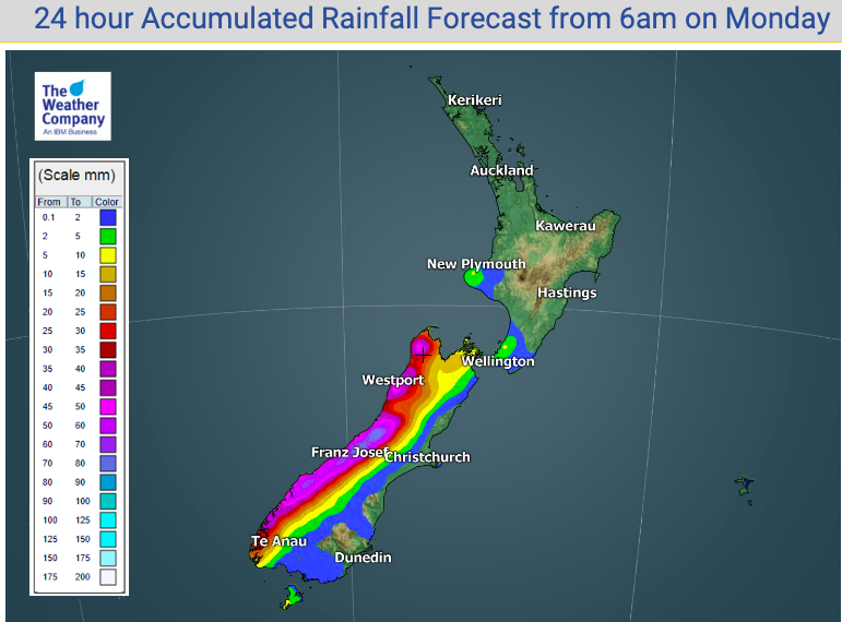
A powerful high pressure zone continues to track over New Zealand but starts to slip away to the east later today, allowing for a milder sub-tropical northerly flow to develop in many regions.
More isolated showers and the odd heavier downpour are possible in the western North Island and once frosts clear from the South Island a stunning day is on the way for many places.
As early as tonight a slight sub-tropical northerly breeze should build in the lower South Island (Fiordland firstly) with a milder Monday and Monday night coming for most places.
To drill down deeper, see the hourly forecasts going 10 days out at WeatherWatch.co.nz and our Free App – or see graphs and more data than any other weather site for New Zealand at www.RuralWeather.co.nz (app coming later this year).


- WeatherWatch.co.nz / RuralWeather.co.nz
Latest Video

Slow moving low to track over northern NZ
A low pressure zone will slowly cross the North Island over the coming days, bringing hit and miss pockets of…
Related Articles
Slow moving low to track over northern NZ
A low pressure zone will slowly cross the North Island over the coming days, bringing hit and miss pockets of…

NI low pressure, SI polar change
Low pressure will move over the upper North Island this week, bringing hit and miss pockets of heavier rain into…

Rain & showers this weekend, colder change next week
Some places will warm up over the next day or so as a nor’wester out of Australia moves across NZ,…

