Sunday’s national forecast – High pressure arrives but some have a cool, cloudy, wet day
5/10/2019 3:00pm

> From the WeatherWatch archives
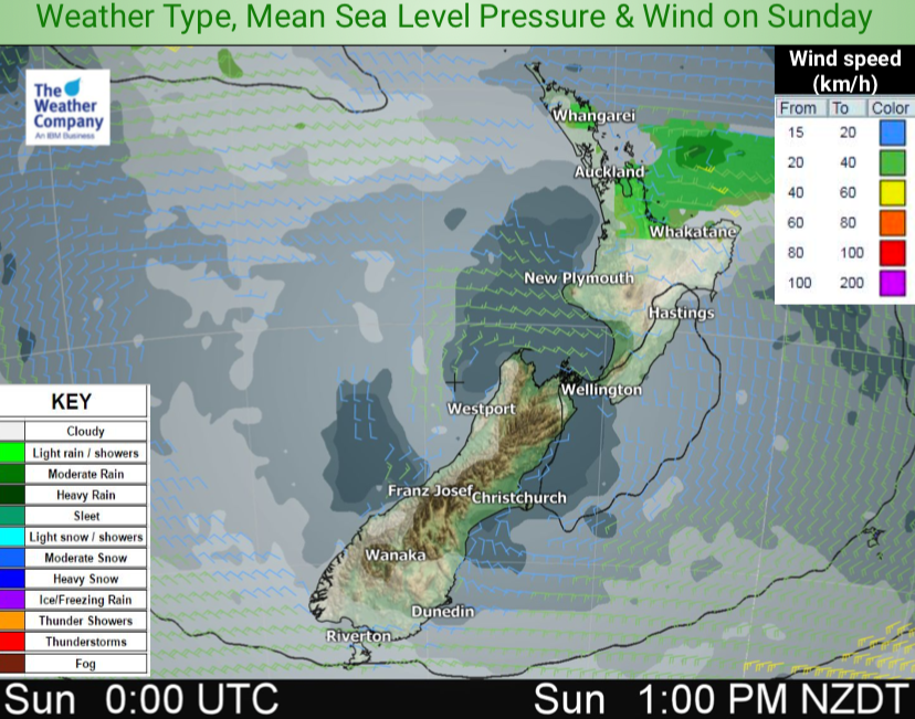
A cold front disintegrates over the upper North Island this morning and as we said the other day it may linger leaving a bit of a cloudy morning with a few light showers and drizzle patches possible.
The front brings some rain to the eastern North Island too, along with a southerly, which clears into the afternoon.
Elsewhere, however, high pressure is definitely expanding with a mostly dry and fairly sunny day across about 70% of New Zealand.
NORTH ISLAND:
Cloud with drizzle and light showers in the upper North Island earlier this morning then breaking up and clearing as we head towards noon as high pressure grows. Some rain moves up the eastern North Island then clears with the southerly change behind it as the day goes on but some of the showers will feed into Bay of Plenty of and Coromandel Peninsula this afternoon and evening. In the southern and south western sides of the island it’s sunny or fairly sunny with cool southerlies fading. Coldest in the east of the island.
Highs: 12 to 18
SOUTH ISLAND:
A frosty start for some with high pressure expanding with a dry day and fairly sunny conditions, especially inland. Many places milder by afternoon than they were yesterday. Winds mostly light, some have southerlies but they should fade.
Highs: 8 to 17
– WeatherWatch.co.nz
Latest Video

Wintry burst of weather: Snow, squally showers then sunshine & frosts
A polar change (another one!) arrives on Friday for the South Island and goes nationwide on Saturday, leaving NZ under…
Related Articles
Wintry burst of weather: Snow, squally showers then sunshine & frosts
A polar change (another one!) arrives on Friday for the South Island and goes nationwide on Saturday, leaving NZ under…

Antarctic southerly for parts of NZ Fri & Sat
For the first time this year a southerly from off Antarctica is heading towards the South Island, followed by more…

Meteors – Your Eyewitness Reports!
WeatherWatch.co.nz receives meteor reports from all over New Zealand and the globe, 24/7/365. **CASUAL COMMENTS**If you’ve seen something in the…

