Sunday’s national forecast – A mild day for the middle of June (+8 Maps)
12/06/2021 4:00pm

> From the WeatherWatch archives
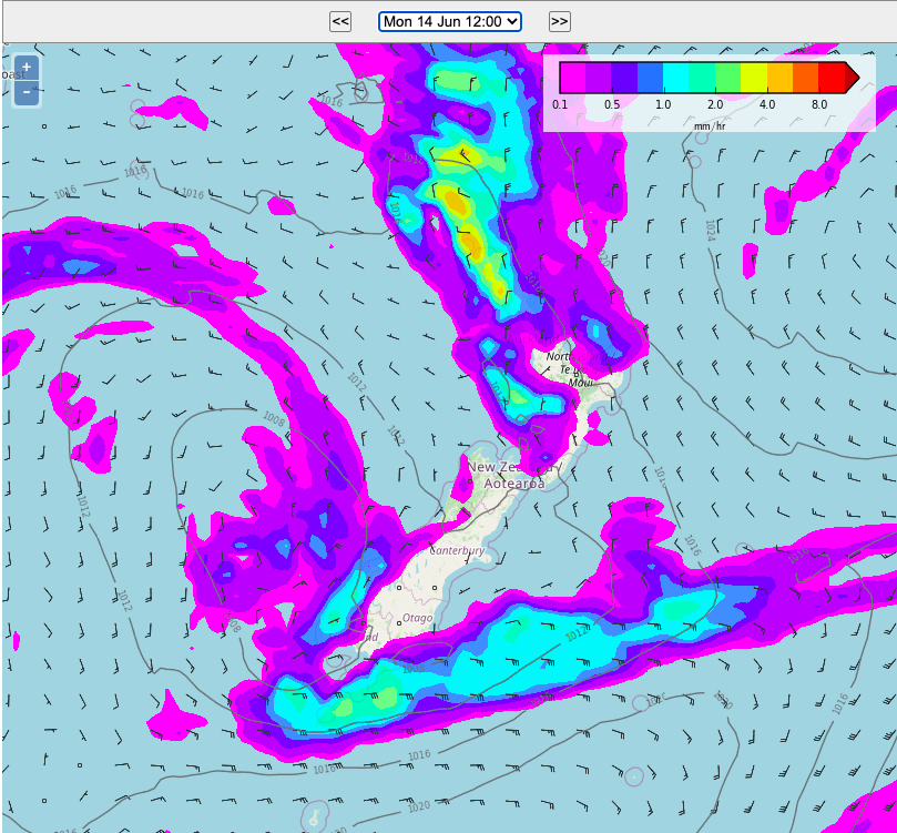
Rain clouds are gathering in the north and west of NZ with heavy rain on the West Coast. Rain will spillover into Southland and some parts of Otago while showers in northern NZ will start to increase.
It’s yet again another mild day around NZ.
Wind directions are mainly from the northerly quarter nationwide, with some regions getting sub-tropical airflows pushing temperatures above normal both today and tonight.
Full details are in your Local and Hourly forecasts at WeatherWatch.co.nz and RuralWeather.co.nz.
The Maps below can all be found at WeatherWatch.co.nz (links below maps) and are all interactive and free to access. Have a wonderful Sunday!


https://www.weatherwatch.co.nz/maps-radars/temperature/temperature

https://www.weatherwatch.co.nz/maps-radars/temperature/temperature


Latest Video

More eastern rain, but a drier long weekend coming
Rain continues today along the eastern South Island and lower North Island, coming in from the east with heavy falls….
Related Articles
More eastern rain, but a drier long weekend coming
Rain continues today along the eastern South Island and lower North Island, coming in from the east with heavy falls….

More heavy rain, snow – but large dry areas, especially as we go into the long weekend
Heavy rain will continue for parts of Canterbury and Marlborough over the next day or two and it will gradually…

Large low brings rain, downpours & some snow – gets colder as the week progresses
Low pressure will cross the upper North Island in the days ahead and that set-up actually pushes more heavy rain…

