
> From the WeatherWatch archives
If you’re looking after the kids or grandkids this week you’re probably loving the weather – a nice big high pressure system is covering the central part of the country spreading mostly settled/calm weather over both islands.
Apart from a couple of isolated showers here and there it’s not only dry, but mild – great weather for being outside.
The current high is a solid one, it will last until the end of Friday.
WATCHING THE WET WEATHER THIS WEEKEND
The wet weather kicks off this weekend (but of course). On Friday evening a cold front will approach Fiordland with rain spreading up the West Coast with heavy falls.
On Saturday heavy rain will spread up the entire West Coast. Watch for possible rain warnings.
Only showers are likely over in Otago and Southland and probably parts of Canterbury.
Overnight Saturday and into Sunday the heavy rain from the narrow cold front will push into the North Island, clearing into the afternoon. Showers will continue on Sunday around Southland and the West Coast.
Monday sees dry weather in most inland and eastern areas – but a few isolated downpours will remain along the entire western coastline.
NEXT WEEK – MORE HIGH & DRY
Next week is looking just as dry as this week, once we get past Anzac Monday.
High pressure dominates from next Tuesday through until next Friday with just a few showers around Northland and Fiordland.
– Image / 8 days from now, next Thursday, shows another big high over the country / WEATHERMAP
– WeatherWatch.co.nz
Latest Video
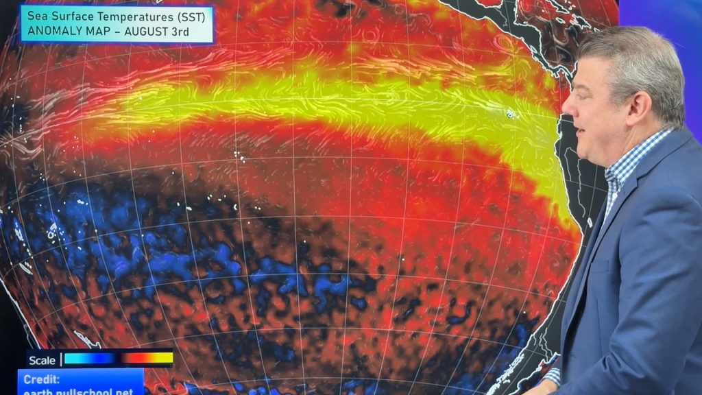
ClimateWatch: AUGUST outlook & El Niño update
El Niño continues to intensify and will do so right through to the end of our spring in NZ and…
Related Articles
Cold frosty southerly heads north, then high pressure and a weekend change
Another shot of colder air is coming for New Zealand over the next day or two, bringing frosts from the…

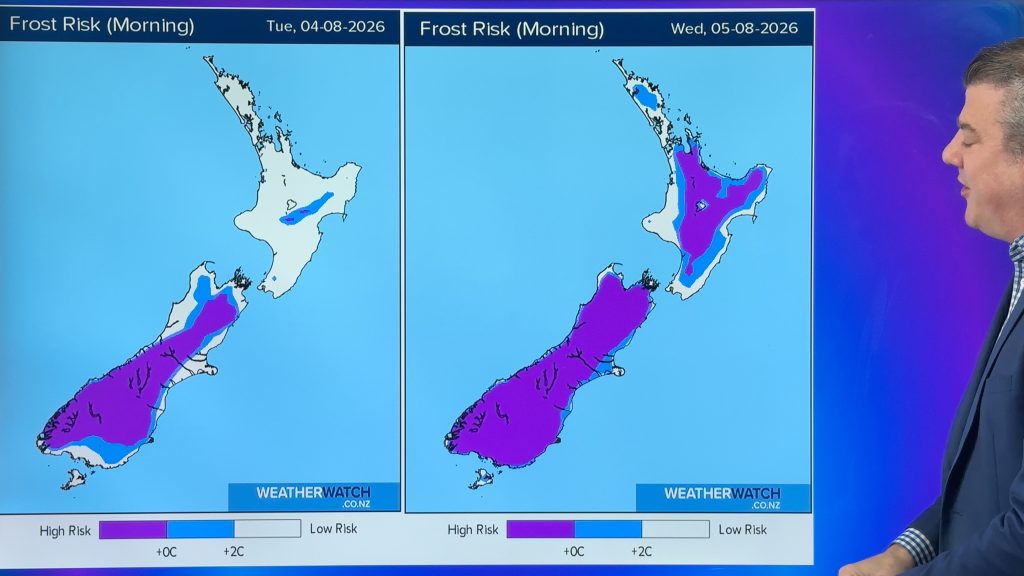
Cold weekend, frosts return with high pressure, then a low late next week
The subantarctic airflow spreads over NZ today/tonight and into Saturday, dropping temperatures nationwide. Snow flurries are possible today to lower…

Wintry burst of weather: Snow, squally showers then sunshine & frosts
A polar change (another one!) arrives on Friday for the South Island and goes nationwide on Saturday, leaving NZ under…

