Some are asking where winter has gone as more mild weather comes NZ’s way, despite the cold
23/07/2018 12:40am

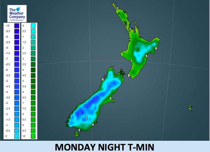
> From the WeatherWatch archives
We’re at the coldest point of the year traditionally. We’re a month past the shortest day of the year, the nights are long and mid July to mid August is often the darkest depths of winter temperaturewise for New Zealand.
But it appears this July isn’t quite playing ball and it backs up something WeatherWatch.co.nz says every year. New Zealand is, in essence, two large islands in the Roaring Forties and each low and high pressure system can dwarf us as a nation and channel either sub-tropical air, sub-antarctic air or airflows from Australia.
This week many parts of the southern half of the South Island have a cold week with single digit highs for many areas to the south and overnight lows dropping back to frosty. There are snow showers today on the ranges. It will feel like winter if you’re in Southland and Otago and other higher up areas.
However in the North Island the week ahead becomes mild once again for the time of year. Sure, maybe the daytime highs aren’t too flash this week but overnight lows are certainly above normal with regions like Waikato looking frost free. Wednesday morning has the best chance of a frost but even Taupo only drops to +2.
Wairou, in Central Plateau, is 792 m (2,598 ft) above sea level and smack back next to Mt Ruapehu. While a little cold over the next couple of nights the daytime highs this week there are around +7 and +8C despite the southerly change moving in. Overnight lows there drop to -1C next couple of nights but the rest of the week the lows are +3 and +4C.
Christchurch looks frost free, or mainly frost free, with lows as mild as +6 and highs as mild as 13 or 14 degrees and, with the exception of the next day or two, also mainly sunny and dry.
If you want cold, head to Queenstown. With low level snow flurries today and tonight on the ranges the town has highs hovering around just +3 to +7 this week. While tonight temperatures may drop to -3C through parts of Otago it may be too breezy or mild later in the week for sub zero overnight lows, even in the South Island.
Winter peaks in August, so just like how summer often peaks in February we still have several more weeks to go just yet before spring really locks itself in. Remember in mid August in 2011 we had a major snow storm in Christchurch and Wellington and even snow flurries fell in Auckland City. While that isn’t likely to happen this year (as only happens about once every 30 years) it does show that we’re not out of the woods yet, but WeatherWatch.co.nz says no major change in our current weather pattern over the next 14 days.

– WeatherWatch.co.nz
Latest Video

Cold weekend, frosts return with high pressure, then a low late next week
The subantarctic airflow spreads over NZ today/tonight and into Saturday, dropping temperatures nationwide. Snow flurries are possible today to lower…
Related Articles
Cold weekend, frosts return with high pressure, then a low late next week
The subantarctic airflow spreads over NZ today/tonight and into Saturday, dropping temperatures nationwide. Snow flurries are possible today to lower…

Wintry burst of weather: Snow, squally showers then sunshine & frosts
A polar change (another one!) arrives on Friday for the South Island and goes nationwide on Saturday, leaving NZ under…

Antarctic southerly for parts of NZ Fri & Sat
For the first time this year a southerly from off Antarctica is heading towards the South Island, followed by more…

