
> From the WeatherWatch archives
March and April have been exceptionally wet in many parts of the country and the latest public soil moisture deficit maps still reflect just how much rain has fallen.
“We had sub-tropical set ups in March then two ex-cyclones, all have delivered significant amounts of rain to various parts of the country” says WeatherWatch head forecaster Philip Duncan.
“Recent rain makers have come in from the west, north and east making for wetter than average conditions still being felt today” says Duncan. “There’s one exception, Southland remains drier than average and while a few showers may move in over the next 10 days the bulk of the next burst of rain again looks to be west and north”.
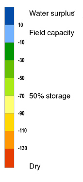
Below – The latest soil moisture deficit map owned by the NZ Government and taxpayers and created by the National Institute of Water and Atmospheric Research – a Crown Research Institute.

– Story by WeatherWatch.co.nz
Comments
Before you add a new comment, take note this story was published on 24 Apr 2017.
Latest Video

NZ 11-day forecast: Covering Easter weekend weather
This week looks to be mostly about high pressure and a few isolated showers/downpours. Easter Weekend may be similar –…
Related Articles
NZ 11-day forecast: Covering Easter weekend weather
This week looks to be mostly about high pressure and a few isolated showers/downpours. Easter Weekend may be similar –…

Update on severe weather around NZ as storm moves in + outlook for next week
Heavy rain and damaging wind gusts are forecast today, tonight and into Friday across parts of New Zealand as a…

Subtropical storm moving in, gales and some heavy rain, especially Thu/Fri
Heavy rain and gale winds will slowly move down the country over the next 24 to 36 hours a subtropical…


Add new comment
Guest on 25/04/2017 4:53am
oh its drying out theres not that much dark blue I don’t find it boggy any more near katikati
Reply