September: Get ready for spring chaos! (+2 long range Maps)
26/08/2019 1:13am

> From the WeatherWatch archives
The next 10 weeks ahead are traditionally NZ’s most chaotic of the year with winter slowly fading and hints of summer coming in. You can expect a real variety of weather with bigger highs drifting out of Australia towards us but also bigger lows in and around the New Zealand area churning the weather up.
Mixing large lows with large highs can create big temperature swings as various pressure systems pull airflows from further afield, sometimes mild sub-tropical northerlies other times cold Southern Ocean southerlies. Snow and frosts are not exclusive to winter and September is a critical month for growers and farmers in both main islands – sometimes warmer air colliding with cold air can produce snow storms. Even light frosts in September and October can cause millions of dollars of damage to vineyards.
But the chaos also tends to generate plenty of westerly quarter winds. We expect that to be the case for the rest of this week, then they fade for a time as high pressure rolls in this weekend and we leave August for September. Later next week the westerlies may well start up again ahead of some spring rainmakers/lows.
Most signs of winter tend to fade over the next several weeks but some years NZ can have brief wintry snaps even in December. Hints of summer will continue off and on for the next month or two, then should ramp up in November as the windy spring westerlies finally start to ease.
Next Friday September 6 (GFS, American Govt)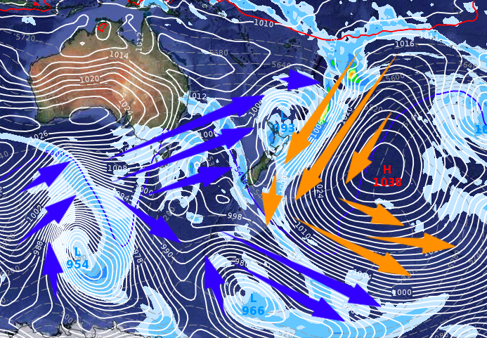
Super Long Range (GFS), 16 days from now, September 11
– WeatherWatch.co.nz
Comments
Before you add a new comment, take note this story was published on 26 Aug 2019.
Latest Video

NZ VIDEO: Severe weather going into the weekend. Next week: Westerlies continue
Heavy rain and northerly gales are moving across NZ going into the weekend as a large low from the Tasman…
Related Articles
NZ VIDEO: Severe weather going into the weekend. Next week: Westerlies continue
Heavy rain and northerly gales are moving across NZ going into the weekend as a large low from the Tasman…

VIDEO: Low pressure, cold fronts, main feature next two weeks
There are several low pressure zones and cold fronts coming into NZ, with westerly driven weather dominating our weather pattern…

VIDEO: Burst of wind and rain for NZ as low pressure dominates
Air pressure around New Zealand will continue to drop in the days ahead as low pressure systems affect our weather…


Add new comment