
> From the WeatherWatch archives
The picture for most regions around New Zealand today is fairly settled due to a ridge of high pressure, a southeasterly airflow over the North Island brings some cloud in the east with a few showers.
For the North Island most regions in the west are mainly sunny today with high’s in the low to mid twenties, some cloud and a few showers for Northland from this afternoon. Along the east coast conditions are mostly cloudy with a few showers, mainly this morning then long dry spells develop from afternoon. Tempeartures in the east sticking around the mid teens.
For the South Island conditions are mainly sunny with morning cloud in the east breaking away. It will be a fairly cool start with inland areas perhaps picking up a light frost. Some cloud Greymouth northwards in the west may bring a shower or two during the day. Winds are light tending onshore this afternoon. Temperatures in the high teens for most however getting into the early twenties along some inland parts of the West Coast, the Nelson region and perhaps inland Southland / Otago.
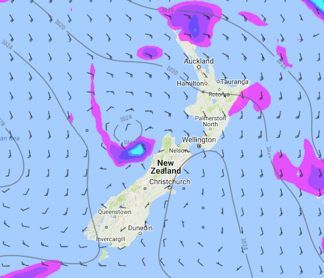
Image – Saturday 10th March 1pm MSLP / Rain map – weathermap.co.nz
WeatherWatch.co.nz
Latest Video

Wintry weather coming: Snow, rain, wind & sunshine
A cold front is moving into NZ from Friday to Sunday with low pressure developing west of NZ and then…
Related Articles
Wintry weather coming: Snow, rain, wind & sunshine
A cold front is moving into NZ from Friday to Sunday with low pressure developing west of NZ and then…

ClimateWatch: JULY outlook & what El Niño means for NZ
El Niño is officially here and still getting stronger in the months ahead, but it’s harder to notice its effects…

Low pressure heading to NZ this weekend & into next week
Many regions have settled weather at the moment with frosts as far north as Auckland this morning, but still some…

