Saturday’s weather headlines (x3): Cool change then settled, Tropical low next weekend in the north?
25/02/2022 6:00pm

> From the WeatherWatch archives
COOL CHANGE MOVES NORTHWARDS
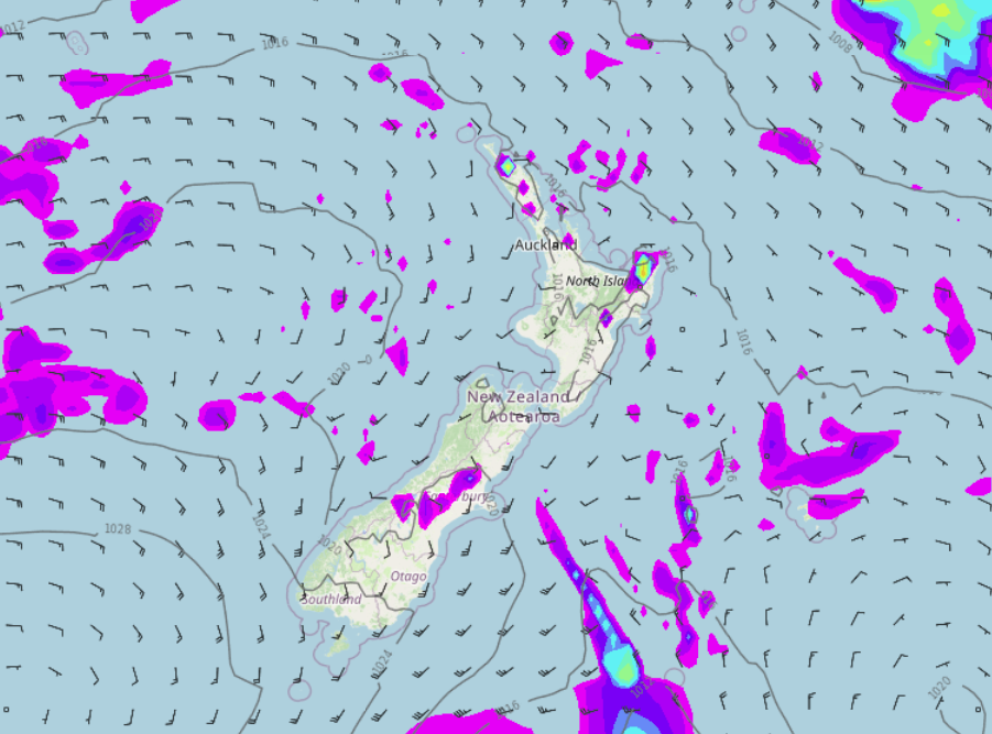
A fairly standard cold front moves northwards over the South Island today, showers this morning for Southland and Otago then Canterbury this afternoon. The odd shower for the North Island this morning, mainly in the east then this evening southerlies move in from Wellington up through to Gisborne bringing showers.

LOOKING MAINLY SETTLED COMING UP
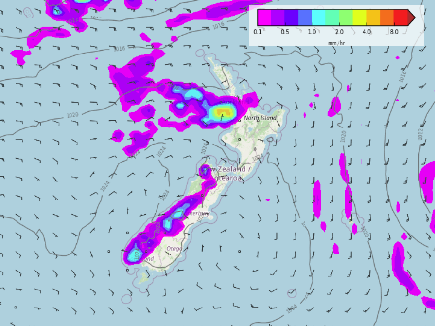
Overall we are looking mainly settled next week with high pressure hanging around. There is the odd shower about for some and Tuesday sees heavy isolated showers about the South Island’s Main Divide, still, most will experience mainly dry weather and areas of cloud especially in the mornings.

TROPICAL LOW NEXT WEEKEND?
There are hints in long range models still of a tropical low bringing rain to the North Island next weekend, something to keep an eye on.
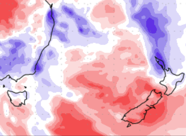
The below image is a “Precipitation (% of normal)” map for the 10 day period, 25th February – 5th March. Red is drier than normal, blue is wetter than normal. As we can see there is quite a bit of blue arriving for the upper North Island towards the end of this 10 day period.

Comments
Before you add a new comment, take note this story was published on 25 Feb 2022.


Add new comment
Annie on 25/02/2022 9:04pm
Hi there. Is it looking like there will be much wind associated with the tropical low? I live on my boat, sonthisnis more of a concern than the rain!
Reply
WW Forecast Team on 26/02/2022 7:23pm
Hi Annie, there may be some strong winds for a time as it passes by later this week. Keep an eye on our daily updates and the wind/air pressure maps. The local land based forecasts near where you are will be helpful to work out how exposed you are. For now it may only be the very top part of Northland exposed to the worst winds and for now no major damaging winds are forecast, but it’s close and big enough to keep an eye on in the days ahead.
Cheers
WW
Reply