
> From the WeatherWatch archives
A low in the Tasman Sea and a departing high will encourage a windy north to north east flow on Sunday and with it will be some pockets of heavy rain.
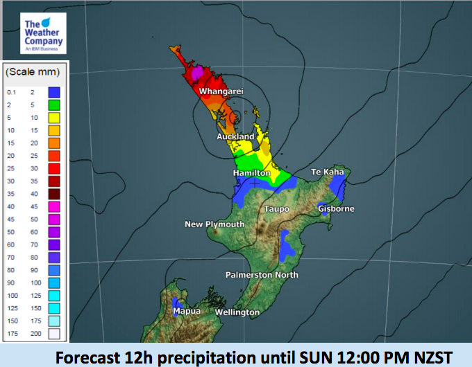
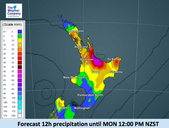
Not everyone is exposed to heavy rain, or even significant amounts. As you can see from our exclusive InfoGraphics below, the upper North Island is most exposed to heavy downpours (with sub-tropical connections). While the rain risk area covers much of the north the band of heaviest rain on Sunday won’t be large in size – so any flooding risks look to be localised.
The NE wind along with King Tides may also bring some coastal flooding, separate from the rain.
Generally speaking rainfall totals look to be between 30 and 50mm in many northern spots which is just below rain warning criteria usually, but due to the slow moving nature of this rain band (blocked by the large high to the east of NZ) coupled with the upper North Island hills and ranges there may be some isolated spots that have the potential to receive over double these forecast rainfall amounts.
– WeatherWatch.co.nz
Latest Video

Cold weekend, frosts return with high pressure, then a low late next week
The subantarctic airflow spreads over NZ today/tonight and into Saturday, dropping temperatures nationwide. Snow flurries are possible today to lower…
Related Articles
Cold weekend, frosts return with high pressure, then a low late next week
The subantarctic airflow spreads over NZ today/tonight and into Saturday, dropping temperatures nationwide. Snow flurries are possible today to lower…

Wintry burst of weather: Snow, squally showers then sunshine & frosts
A polar change (another one!) arrives on Friday for the South Island and goes nationwide on Saturday, leaving NZ under…

Antarctic southerly for parts of NZ Fri & Sat
For the first time this year a southerly from off Antarctica is heading towards the South Island, followed by more…

