
> From the WeatherWatch archives
Several rain warnings have today been issued by the government forecaster ahead of a low pressure system which will cross the North Island tonight.
Rain warnings have been issued for Waitomo, Taupo, Tongariro, Taihape, Hawkes Bay, Wairarapa, Taranaki and Manawatu.
Up to 100mm is possible within 12 hours, with embedded thunderstorms making for sudden heavy downpours.
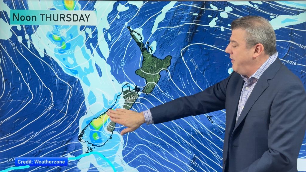
WeatherWatch.co.nz head weather analyst Philip Duncan says the low will move over Taranaki during Wednesday morning then over southern Hawkes Bay in the afternoon. “The low isn’t aggressive but will bring a pocket of rough weather to the middle section of the North Island”.
“We’re advising motorists driving across the North Island tonight that there will be wet and windy conditions south of Auckland and north of Wellington”.
Mr Duncan says by Thursday conditions will be improving. “An anticyclone will move on to upper New Zealand towards the end of the week and weekend however lows in the Southern Ocean will continue to be an issue for South Islanders bringing winds to the south and east of the island and potentially heavy rain to the west”.
Today’s other weather headlines:
Image: Mandeno Moments
Latest Video
A few showers, but still a lot of high pressure
Showers continue in parts of NZ going into the weekend and through next week, we track them for you –…
Related Articles
A few showers, but still a lot of high pressure
Showers continue in parts of NZ going into the weekend and through next week, we track them for you –…
High pressure still in charge, but a few changes in the mix
High pressure continues to control much of New Zealand’s weather although there will be some wind and temperature changes in…
Heavy West Coast rain, a few showers elsewhere
High pressure looks to remain mostly in charge of NZ’s weather until the middle of next week when a potential…

