Rain & Snow accumulation maps for New Zealand as several cold fronts move in
29/10/2018 9:26pm

> From the WeatherWatch archives
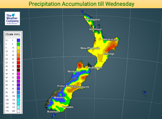
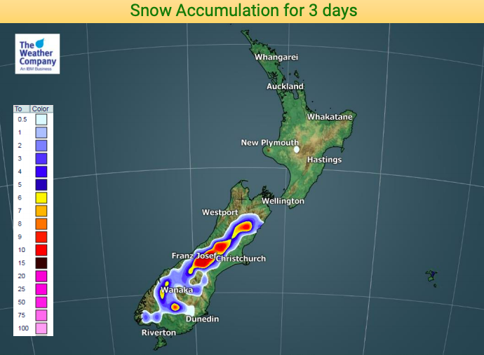
We have a classic spring set up over the next several days with a number of cold fronts and the weather bouncing between warmer than normal and colder than normal, especially around the South Island.
Winds will also come and go over the next several days with perhaps this Saturday looking the windiest and wettest for some regions.
The good news is that regions that have been much drier than average in recent months are getting some rain over the next week. Most dry regions should get some relief.

– WeatherWatch.co.nz
Latest Video

NZ: 8 Day outlook as gales & rain ease, high pressure builds
Damaging wind gusts and heavy rain will continue to affect some parts of the North Island and brushing Marlborough today…
Related Articles
NZ: 8 Day outlook as gales & rain ease, high pressure builds
Damaging wind gusts and heavy rain will continue to affect some parts of the North Island and brushing Marlborough today…

Pockets of hit & miss heavy rain, snow moves northwards
Low pressure continues to slowly move across the upper North Island and for some that will bring the sun out,…

Slow go for northern low & southern cold
For the next few days low pressure will crawl over the upper North Island, driving in rain as far south…

