> From the WeatherWatch archives
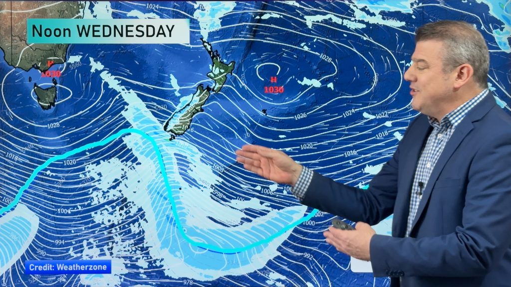
On Thursday we have a rain band, moving north in the afternoon to affect parts of the North Island, while gusty strong winds will blow in places too.
Rain
Heavy rain moves on from North Westland in the morning, to ease away by midday.
This rain moves on to the west of the North Island – Taranaki southwards – in the afternoon, with heavy falls possible.
While probably not as heavy as on the West Coast of the South Island, as this front will weaken a little, a few heavy falls are possible.
Rain then moves into the Waikato later in the evening, but by then heavy falls are not as likely.
Wind
Northwesterlies through Cook Strait and about Wellington will be strong – possibly gale force – before winds change southerly in the mid to late morning.
Northwesterlies along the East Coast of the North Island will be brisk to strong too, before easing in the afternoon and into evening, as some rain moves in from the south.
– Aaron Wilkinson & Drew Chappell, WeatherWatch.co.nz
– Photo: Zelda Wynn
Comments
Before you add a new comment, take note this story was published on 21 Oct 2015.


Add new comment
Guest on 22/10/2015 4:44am
There is surpose to be a high the middle of Aus in winter but there rearly wasnt hence why we had a dry winter….it just the same pattern now like the last three summers….so does that mean we have had el nino for three years!!!!!!!!
Reply
Guest on 22/10/2015 4:38am
So far spring as been utter rubish…..sept was cold a lot of the time and now october is windy and dry how is anything exspected to grow and is after 3 crap summers in a row for grass growth…..Where is that cyclone as we are short of 650 mils for the year and times running out
Reply
Guest on 21/10/2015 7:27pm
RANT ! – Even though Spring is normally the most unsettled season in the Akl region, it appears this year has been one of the worst with almost continuous cloud, and SW winds daily. All of Sept and October appear to have been unendowed with any blue sky and sun – would love to see the sunshine hour stat’s for those months! And, future forecast not looking any better really! So, it will be xmas day or boxing day before there is any sign of settling weather (that’s my prediction) in this El Nino year.
And to reiterate – Daylight saving in Akl – “More daylight to stand inside and look at the crap weather” because you certainly can’t roll out the BBQ and sit in the sun after work! – Well, not in NW Akl region anyway!
Reply
Tim on 21/10/2015 6:50pm
G’day Philip,
Just had our 3rd dry southerly in a row bar a drizzle patch or two.
So far we’ve had 2.1ml of rain this month.
Any sign of an actual rain producing system in the future other than just a wind change accompanied by gale a from another direction?.
Cheers
Reply
WW Forecast Team on 21/10/2015 10:01pm
Hi Tim
Where are you in NZ?
Cheers
Aaron
Reply
Tim on 22/10/2015 12:32am
G’day,
Sorry that would help you.
We are in central Canterbury near darfield.
cheers
Reply
WW Forecast Team on 22/10/2015 12:58am
Indeed.
Tuesday next week appears to be the only window at this stage really, 15mm or so possible on a southerly front but that’s about it for now. We are still a few days out from Tuesday next week though so that could change up a little betweem now and then.
Cheers
Aaron
Reply