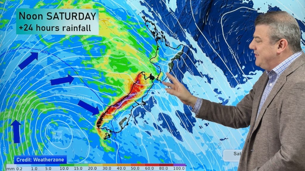
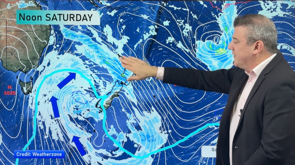
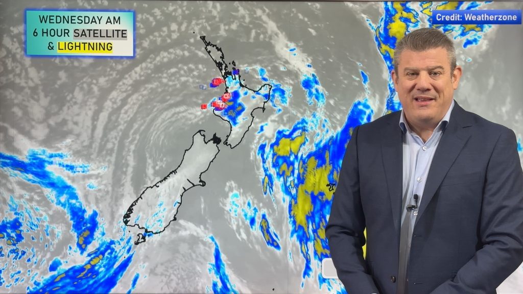
Rain is coming to Northland, Auckland and possibly much of the North Island
13/02/2017 9:52pm

> From the WeatherWatch archives
High pressure is moving in to many parts of the country with winds easing and the sun and warmth returning – but not in the upper North Island where drizzle and high humidity is combining to make for very muggy and grey conditions.
The rain is so light it’s not doing a great deal, although plants will love it – and some on rain water may get enough off the roofs to top up some tanks.
The good news is that over the next few days Northland is most exposed to rain setting in. Soaking rains. Some of our data suggests over 60mm of rain is possible for some. This could put a serious dent in the drought. However it’s very important to note that the area with soaking rains in it isn’t very wide (only about as wide as Northland) so if the rain clouds shift slightly west or east it may leave some farms/properties with only drizzly showers, not enough to end a drought.
Either way, we do expect some big pockets of relief for those with dry properties in northern New Zealand over the next few days.
During Thursday that rain will slide southwards and by Friday may cover much of the North Island with grey skies, drizzle and humidity.
Wellington – we have a clarification/correction too – yesterday we said Wellington would enjoy 7 days “without wet weather”. However the rain clouds in the north now look as though they may have a little more oomph in them than we first thought. This bodes very well for our driest regions further north, but for Wellingtonians wanting the sun this may be disappointing. However we do have good news to make up for it – we’re now expecting another high to move in towards Wellington in a week from now, so while this Friday and Saturday may see a few spits most of next week looks dry. There is also a chance very little may fall in Wellington with little to no rain expected south of Cook Strait. At this stage we expect just 5mm over Fri/Sat.
It’s a bit of a two steps forward, one step back situation for Wellington, but the general trend IS still for Wellington to see more summer-like weather in the second half of February. (Please note, we expect the northern rain clouds to fade out around the Cook Strait/Wellington area so this forecast may be the one that chops and changes a little more than other areas as we try to lock in the edge of the rainclouds – see our map below for more details).
There may be very little rain falling in the east too – but drizzle patches and some downpours may pop up. Northern and western areas are most exposed to potential rain.
The rain clouds aren’t expected in the South Island other than maybe around the Cook Strait area as high pressure will dominate over the island. Any remaining showers mainly clear today. Invercargill, which has a high of just 13 degrees today, warms up into the low to mid 20s by the end of the week and weekend under sunny skies.
New Zealand currently has a neutral weather pattern which means our weather is more chaotic and less in a predictable pattern than say a strong El Nino or La Nina might bring.

– Map – Areas in blue will be wetter, areas in red dry – the rain forecast map for the next 7 days. Note Wellington is right on the edge! / GFS
– WeatherWatch.co.nz
Comments
Before you add a new comment, take note this story was published on 13 Feb 2017.


Add new comment
Jason on 16/02/2017 8:04pm
Hi Team,
A bit specific but we have a special Birthday party planned for outdoor tomorrow evening in Riverhead Auckland.
Forecasts seem to be conflicted between occasional showers and heavy rain. Any clues as to what we can expect precipitation wise and whether to move the venue.
Any insights greatly appreciated.
Reply
WW Forecast Team on 16/02/2017 9:42pm
Hi Jason,
Basically we’re expecting showers to develop, some heavy with isolated thunder possible. There will be large areas of dry too, so very hit and miss. Hopefully you’ll be ok, one positive is that the risk for showers increases the further south you go.
Keep an eye on our forecasts on Saturday, we’ll likely be updating a little more often (as we are today in Auckland).
Cheers
WW
Reply
Guest on 14/02/2017 2:42am
Hi what are the chances of a decent total for the South Auckland area? Pretty dry on farm
Thanks
Reply
WW Forecast Team on 14/02/2017 4:10am
Hi there
Chances with these things can be a little hard to narrow down at times, especially considering there has been a lack of good rain for a while in Auckland and northwards. As the story says with this rain moving over Northland it could be a little hit and miss for some, the situation for Auckland may be the same.
But over the course of Thu and Fri there may be 60% chance of 30 to 40mm, a better chance (70 to 80%) of say 20mm. If it stays consistent in weather models tomorrow as it is now those chances go up 10 to 20% respectively.
Best of luck!
– Aaron
Reply
Guest on 13/02/2017 11:04pm
Metservice indicating rain with heavy falls for Gisborne through to Wairarapa where as you guys say very little. Will b interesting to see who gets it right. 🙂
Reply
WW Forecast Team on 13/02/2017 11:57pm
There definitely may be some heavy falls – we mention the risk of downpours popping up but drizzle in there too. If we get a good downpour forming around Gisborne or Napier there could be a solid period of rain with maybe 25 to 40mm of rain possible. The bulk looks likely to be in the ranges (was our initial point). If we can get a good nor’east flow in there then that rain may do better at sliding down the eastern coastline towards Wairarapa (but you’re heading into higher pressure as you do that). Friday looks like the best day for rain from Gisborne to Wairarapa and we’ll be going into much more detail about Gisborne and Hawke’s Bay’s rain chances on Wednesday morning.
Cheers
WW
Reply