
> From the WeatherWatch archives
Each Saturday morning head weather analyst Philip Duncan writes a column about the weather, environment, space and politics
Big tropical low(s)
 What a truly weird week of weather over the North Island. Sorry South islanders – your weather has been stunning for the most part, but it’s been the North Island that’s had just about every weather prediction you can think of, except snow and hail, across this week.
It all started two weeks ago when we first noticed an expected tropical cyclone somewhere near Vanuatu and Fiji. Sure enough the cyclone did form as predicted and in the right location a week later. However by then a number of other lows had popped up closer to home. In the end a giant pool of low pressure developed, covering an area that stretched from the upper North Island all the way to Fiji.
This big pool of low pressure removed much needed resources to help Daphne stay as a cyclone – but instead it cannibalised itself.
Cyclone Daphne – which only made Cat 1 – got caught up in this large low and fell apart quite quickly. The whole system became so big much of the centre (which was at least as wide as NZ is tall) was filled with – get this – blue sky and light winds. Not the first thing you think of when you talk about a large tropical low.
But the system was nasty – and the potential it carried was enormous. Only a few small tweaks would’ve seen more wind and rain warnings – so in this case, we were lucky.
Auckland
And it was a few small tweaks that saw a dramatic change in Auckland’s weather this week. The very slight shift from an easterly wind to a south easterly saw the heavy rain that was predicted for the city instead fall just a few kilometres east over the Hauraki Gulf for most of the day.
As the low grew in size so too did this south east wind. It was no longer a local sou’easter, it was not an entire south east flow across the North Island. For those in Auckland, Waikato and Bay of Plenty this meant little rain and instead very warm and often sunny weather.
This would not have happened had the winds stayed easterly. It would’ve been cloudier, cooler and wetter.
Sou’east flows aren’t that common in the upper North Island – so when we get them the weather can be fantastic. But it’s always a fine line between a sunny and warm sou’easter and a cloudy and cool easterly.
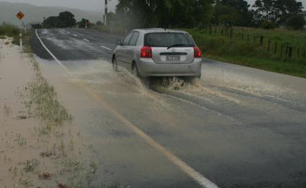
But while these regions enjoyed some surprisingly sunny and warm weather, Gisborne, northern Hawkes Bay, Northland and East Cape all took it in the shoulder – with the predicted tropical low dumping flooding rains and causing yet more slips and road closures for the Gisborne region.
Accuracy
I was called by a reporter this week asking about accuracy in forecasts. This person had originally called MetService but ended up calling WeatherWatch.co.nz for a direct answer – rather than being directed to the MetService annual report.
We won’t comment on the accuracy of MetService day to day forecasts – we feel that’s your call to work out who is more accurate in your region. I said to this reporter that WeatherWatch.co.nz has much stricter rules than some others for ticking off accuracy. Our basic policy is this – if the majority didn’t get what was generally predicted, then our forecast was wrong. Simple as that.
For example – if we predict showers across Auckland, this would only be deemed accurate if at least 60% of the suburbs had them. If there’s a shower in the Waitakere Ranges and another in Albany – we deem our forecast to be incorrect.
Whenever we get it wrong, no matter how small, we always look to see why – and to improve on it for next time. Sometimes this is as petty as the wrong icon used (I hate nothing more than seeing a cloudy icon up when it’s beautifully sunny, for example).
If we get it spectacularly wrong – as all forecasters did for Auckland this week – we’ll front up about it. Not from public pressure – but because it’s the right thing to do.
We sent a rare press release to the media on Wednesday morning which was picked up by Stuff.co.nz.
So this week has been a learning curve for us. While we never promised a direct hit from a storm, we did predict a lot more rain and with high confidence too. And while I know that the rain fell very close to Auckland city that doesn’t make a wrong forecast any less wrong. Whether that rain was 50kms offshore or 500 – it was incorrect, so we fronted up.
But just remember – without this large tropical low hovering around the North Island we wouldn’t have had the stunning weather over the past few days in the central and western part of the North Island – so it has certainly played a huge role in the North Island’s weather this week – just not a negative role in most people’s view.
And South Islanders – we haven’t forgotten about you – you’ll be back in the weather news headlines next week as the Southern Ocean starts to wake up a bit more – and a cold, wet, change kicks in on Tuesday for the Deep South.
I wish you all a Happy Easter – or simply just a few relaxed days off work
– Follow Philip Duncan on Twitter by clicking here
– Image / File, Simon Williams
– WeatherWatch.co.nz
Comments
Latest Video

Matariki, the long weekend + the outlook for next week
Wet weather and cloud continues along the eastern side of the country with the heaviest rain now moving into northern…
Related Articles
Matariki, the long weekend + the outlook for next week
Wet weather and cloud continues along the eastern side of the country with the heaviest rain now moving into northern…

More eastern rain, but a drier long weekend coming
Rain continues today along the eastern South Island and lower North Island, coming in from the east with heavy falls….

More heavy rain, snow – but large dry areas, especially as we go into the long weekend
Heavy rain will continue for parts of Canterbury and Marlborough over the next day or two and it will gradually…


westcoast on 7/04/2012 9:18pm
note that not all SE flows result in warm sunny weather for Auckland/waikato….
this particular SE flow had the moisture at low level, i.e relatively low cloud, which was easily blocked by the east coast ranges
but sometimes the rain bands are upper level, and pass over the ranges easier, and give rain from upper level cloud sheets, to the waikato/auckland area, in a SE wind flow
Glenda on 6/04/2012 9:18pm
I think we all need to remember that weather infomation is called a forecast not an absolute.
But hey the suns out now in the North and we have had no more rain since Friday.
weather-nut on 6/04/2012 8:46pm
Tropical Cyclone Daphne did actually attain Category 2 status on the Australian Scale early on Tuesday morning, with estimated 10-minute mean-winds of 50 kts (93 km/h), gusts to 65 kts (120 km/h) and a central pressure of 985 hPa. She rapidly began falling apart structurally not long after that. Of course on the American Saffir-Simpson Scale, she’d still only rate as a ‘Tropical Storm’.
Kelly on 6/04/2012 8:45pm
Let’s face it, weather is something we can’t control. It is changeable and unpredictable and no matter how experienced the forecasters are nobody can be 100% all of the time. I think Phillip Duncan is brilliant and really felt for you WW folk this week because I accurately predicted you’d get some backlash!! Is it possible to predict what will happen in 2 days time when the guy 10 cars ahead on the M’way doesn’t see someone changing lanes in front of him? Can anyone predict what their toddler will be doing in 10 minutes if left to their own devices? Can anyone tell us exactly to the cent what the dollar will be trading at by the end of the week? Bottom line, it is useful being able to rely on forecasts and even vital in times of Severe Warnings but all in all you guys do a brilliant job and people need to remember nothing is set in stone and no matter how good Weather Watch are, they/you can’t control the Weather. Happy Easter!!
Ken Ring on 8/04/2012 12:32pm
The tides can be predicted fairly well, and cycles are more potent than is fully realised. Nature is more patterned than random, as we can see every year with seasons and cyclones and less obviously with earthquakes. What is needed is more of a desire to identify cycles, but the research funding is not there. There is subsequently little emphasis on developing longrange equpiment. There is some, like for Tahiti/Darwin SST comparisons for the SOI. Logic dictates that if seatides can be predicted, then whatever is connected to seatides, like land tides beneath the seas and atmospheric tides above the seas, must also be patterned. Because mainstream science does not go there does not mean the cycles are not to be found. There are proven earthquake patterns, cyclones and monsoonal systems. Anyone who mines Geonet’s statistics could tell you the year and location of the next above-7M earthquake in NZ. The pattern for those has been perfectly regular, on strict 12-13 or 23-24 years and tied to sunspot cycles. This pattern can be shown in this country since the 1800s without a miss. The funding is the main issue. Uncertainty brings more funds, and accurate prediction would curb any need for further research.
Gary on 9/04/2012 2:11am
No need to wait for funding Ken, here’s a DIY guide for coming up with cycles http://www.youtube.com/watch?v=qGgfub0-bIU I thought it was much better when it had scarey music though.
Ken Ring on 10/04/2012 3:43am
Whilst it is true one can easily cherry-pick for evidence and come up with a theory, as the IPCC/NIWA has done repeatedly with global warming and climate change, it is simply not true in the case for earthquakes in NZ, which appear to follow the cycles of sunpsots. Fortunately since the 1880s the above-7Ms in NZ have been few enough to be able to plot per region. None fall outside of the solar-lunar cycle. Also with cyclones – most occur in equinox months. It is why we say cyclone “season”. “Season” refers to the equinox, as in ‘seed’ and ‘sow’, and the word cyclone is derived from the word “cycle’. If your link and its smug narrator were intended to show there are no cycles in nature then of course it failed. All farmers know about and experience cycles, whereas statisticians just sit in front of computer screens trying to sound important.