Next 48hrs: Rain pushes down eastern NZ with some heavy falls, warm in the west (+3 Maps)
24/11/2018 6:00pm

> From the WeatherWatch archives
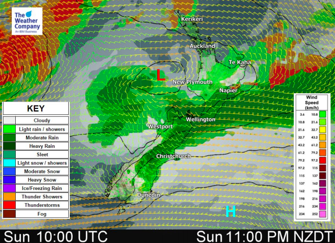
A large low in the Tasman Sea now spreads partially across New Zealand and is feeding in a wet nor’easter down the eastern side of both main islands.
Some areas might have heavier falls as the slow moving band of rain locks in around the central part of New Zealand / upper South Island overnight and through Monday. Hawke’s Bay will get some rain later today and tonight but it may not be enough for those who are wanting/needing rain. Monday looks drier in Hawke’s Bay at this stage.
Much further south in the South Island and rain shouldn’t be too heavy down towards Coastal Otago, good news after recent heavy rain caused some flooding there.
Meanwhile the east to north east air flow will push temperatures down on the eastern coastline, some below average so west is best if you want the heat with the West Coast one of the driest and warmest places in New Zealand for Sunday and fairly mild and dry but cloudy on Monday too. It will be much warmer than average in western and inland parts of the South Island on Sunday in particular with highs around 23 or 24C in the west compared to just 12 to 15C in the east. The North Island is a little more steady and even but again east is cooler and west is warmer.


– WeatherWatch.co.nz
Latest Video

NZ: 8 Day outlook as gales & rain ease, high pressure builds
Damaging wind gusts and heavy rain will continue to affect some parts of the North Island and brushing Marlborough today…
Related Articles
NZ: 8 Day outlook as gales & rain ease, high pressure builds
Damaging wind gusts and heavy rain will continue to affect some parts of the North Island and brushing Marlborough today…

Pockets of hit & miss heavy rain, snow moves northwards
Low pressure continues to slowly move across the upper North Island and for some that will bring the sun out,…

Slow go for northern low & southern cold
For the next few days low pressure will crawl over the upper North Island, driving in rain as far south…

