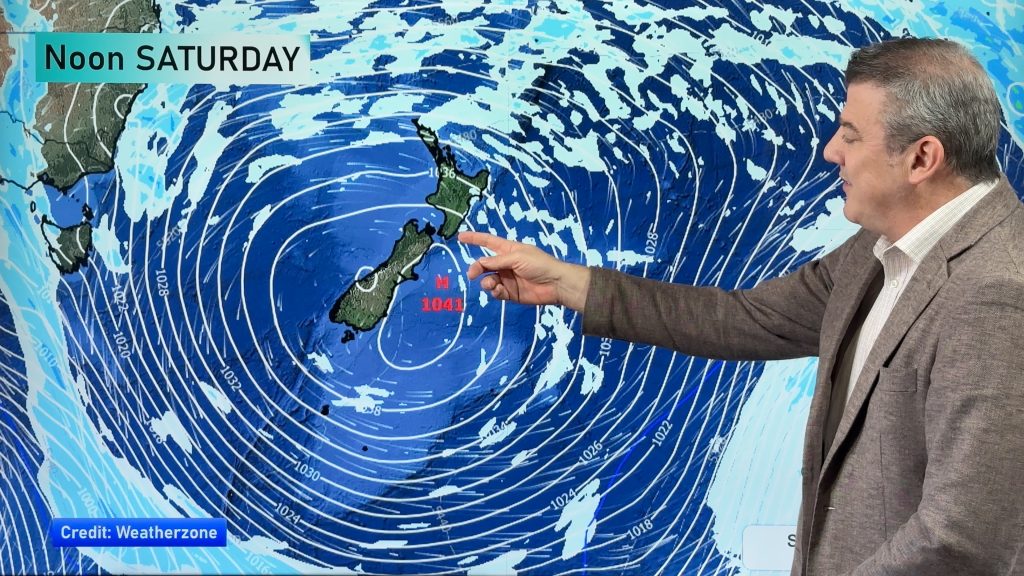
> From the WeatherWatch archives
We’re in the depths of winter but you’d be forgiven for thinking we were maybe in September or spring with the wall of westerlies that have been blowing across a number of regions for the past few days. While not everyone has had windy weather, the long range forecast by WeatherWatch.co.nz shows there are plenty more windy days to come.
“We have a lot of nor’westers, westerlies and sou’westers coming into New Zealand for possibly the rest of July,” says head weather analyst Philip Duncan. “The general weather pattern at the moment is seeing massive high pressure systems over Australia and stretching to our north – this places New Zealand on the southern edge of the highs where the strong westerlies blow”.
While windy westerlies in winter aren’t all that unusual, it is unusual to see week after week with strong westerlies blowing through. “This is very much like the weather patterns we see around September in our part of the world.”
It’s not warm everywhere, though – a week ago some centres through Otago and in Canterbury were at -3 in the middle of the afternoon. This was due to very calm winds and fog or cloud for most of the day. The windier weather favours fewer frosts but does encourage a bit more snow on the mountains.
In 2011 we had a neutral weather pattern that saw record-breaking warm winter months in June and July, then a violent snow storm in mid-August saw snow flurries in parts of Auckland City and the hills of Northland.
El Nino died away in Autumn this year. There is some talk we are heading towards La Nina this spring, but right now the weather pattern feels more like El Nino (windy westerlies and drier in the east like Canterbury). August may see a break in this current pattern, like it did in 2011, but it’s very hard to forecast in advance – especially when the long range maps show almost two weeks of mostly westerly quarter airflows.
While there may be some brief calm spells, or different wind directions, these aren’t likely to last more than a day or two before westerly quarter winds return.

Wind map for NEXT Wednesday (July 27th) shows windy westerlies continuing on and stretching from South Africa right across the Southern Ocean, south of Australia for the most part then straight across Tasmania the Tasman Sea and into New Zealand – indicating this could go on into August / Maps by Weathermap.co.nz
– WeatherWatch.co.nz
Comments
Before you add a new comment, take note this story was published on 17 Jul 2016.


Add new comment
Tony Hastings on 18/07/2016 9:12pm
I see that Tropical Cyclone 01S (Abela) is bearing down on Madagascar. Isn’t it pretty unusual to have an active cyclone during a southen winter? Could this possibly be a sign of climate change? Thanks.
Reply
WW Forecast Team on 18/07/2016 11:44pm
Hi Tony, no this isn’t part of Climate change, in fact Madagascar does receive some cyclones in winter. You’ve prompted us to reach out to our senior meteorologist friends at Weatherzone in Sydney so we’ll have a news story up about this later today 🙂 Thanks for the interesting question.
Cheers
Philip Duncan
Reply
Guest on 18/07/2016 1:52am
I saw a animation of the Southern Hemishere jetstream yesterday – not sure of the altitude but the jetstream was certainly cracking around the Earth at breakneck speed.
Any info on this?
Cheers
Reply
WW Forecast Team on 18/07/2016 3:55am
Hi there – there are two jet streams near New Zealand, one to our north (between the North Island and Fiji) and the other to our south (generally between the South Island and Antarctica). In winter the southern jet stream heads north and opens up New Zealand to very cold air during polar outbreaks. In summer the northern one can slide down and bring in tropical weather, often around a tropical cyclone or sub-tropical low. Basically they are high altitude narrow highways of very fast moving wind (a few hundred km/h) and are the separating boundaries between air, like the tropics to our north and the polar air to our south – with NZ being sandwiched in the middle where it’s not too hot and not too cold. When you fly north to the tropics, or fly across the United States or Canada, you can fly through these jet streams. Flying through them is very normal but causes turbulence and planes sometimes fly above or under them to make for smoother flying.
Kind regards,
WeatherWatch
Reply
Dave on 18/07/2016 1:17am
Hi Phil
In the past I have noticed that during winter the lows “boss” the highs & in summer the opposite happens
It seems very much that the lows are firmly in charge so I agree with you that the present setup will continue
What we really need is the highs to come through at lower lattitude for there to be any change
Cheers Dave
Reply
WW Forecast Team on 18/07/2016 3:49am
Hi Dave, yes the highs are just so far north now we’re just seeing a lot of westerly quarter winds. As you say drop those highs further south – or – change their shape from stretching west to east, to stretching north to south (that way it not only brings in wintry southerlies, but then sunny/calm/frosty weather). Maybe in August!
– Phil
Reply