> From the WeatherWatch archives
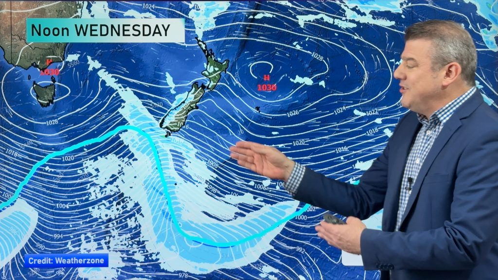
A large low in the Tasman Sea poses a firm risk for more slips and flooding in regions that have already been swamped by heavy rains in recent weeks.
The heaviest rain may linger for two or three days for some places, while others may see sunshine mixed with the odd heavy shower – both set ups capable of producing more problems.
WeatherWatch Head Analyst Philip Duncan said “In the north it will be heaviest overnight tonight and on Sunday morning, then from Sunday afternoon until possibly Wednesday eastern areas of the South Island look likely to be hammered by relentless rain”.
Mr Duncan said yesterday that Waikato, Coromandel Peninsula, western Bay of Plenty, Gisborne and Canterbury don’t need more rain – yet those are the exact regions being targeted by this incoming low.
Already rain is falling about the upper parts of the North Island. Northland, Auckland and the Coromandel Peninsula are all seeing some precipitation late this afternoon.
WeatherWatch Facebook readers said that the day may have started off settled about Auckland, it has already begun to turn grey, windy and rainy.
Juliette Banks of Birkdale said that she felt a temperature drop around 2:30 this afternoon and it was cloudy and windy and looking like it could bucket down. All of that after what she said was a lovely morning.
Mr Duncan says the sub-tropical nature makes the rain clouds more “explosive” which can lead to torrential downpours which cause flash flooding and slips.
Mr Duncan adds “This low is a big one – bigger doesn’t always mean more aggressive but the bigger they are the more reach they have, pulling in cold air for Sydney, where snow has fallen inland, and for New Zealand on the other side it’s the opposite, pulling down warm sub-tropical air from near New Caledonia and producing some heavy bands of rain”.
WeatherWatch Analyst Howard Joseph says the centre of the low is currently about midway between Australia and New Zealand, but a frontal boundary attached to the low is being driven south across the country. Joseph says “That’s the focus for the showers, heavy rain and possible thunderstorms. As that continues to slide south tonight, so will the threat for heavy and thundery falls.”
Mr Joseph says there is a high risk for flooding and slips in Canterbury and a moderate to high risk for more localised slips and flooding across Waikato, Coromandel, Bay of Plenty and Gisborne – although the rain bands here may be heavier, they should be faster moving.
Auckland, Northland, Hawkes Bay, Wairarapa, Wellington, Marlborough and Otago may also receive rain heavy enough to cause more minor flooding – and potentially slightly more serious flooding if the system slows down or targets these areas a little more.
Mr Joseph adds “For the upper North Island there’s about 12 hours of rain on the way, with some torrential falls over a 3 to 6 hour period tonight or Sunday morning. For places like Canterbury the rain may linger for two or three days as the low stalls off the east coast”.
Homepage Image/ Simon Williams
-WeatherWatch.co.nz
Comments
Before you add a new comment, take note this story was published on 11 Aug 2012.


Add new comment
Peter of Dunedin on 11/08/2012 7:21am
When you refer to Otago, please be more explicit. It was North Otago that had minor flooding along with more significant flooding in South Canterbury. The rest of Otago barely had enougn to drown a fly in a glass!
Reply
LM on 11/08/2012 8:40am
If Metservice have this one right, you’ll possibly be getting as much from this event as Dunedin recorded for the month of July.
Reply