More low pressure coming – The Big Picture on Friday
22/10/2015 4:00am

> From the WeatherWatch archives
On Wednesday we have a shallow low pressure system sitting east of the South Island, and a northwesterly airflow over the North Island.
A front slides over the upper South Island in the afternoon, before moving on to the lower North Island in the evening.
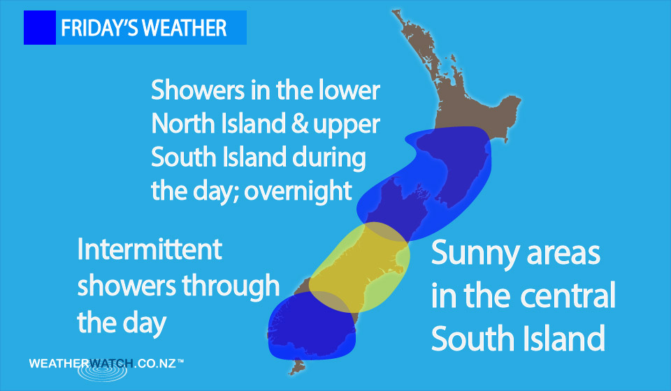
So for the North Island it’s looking mostly cloudy, with breezy northwesterly winds, and the odd light shower from Waikato southwards – with some rain at times in the west, from Taranaki southwards.
Rain picks up south of Taranaki later in the evening and then overnight.
For the South Island things are a little complicated, we have some rain sliding onto the upper South Island from the west in the afternoon, and showers about the lower South Island.
In the middle we have sunny areas and south to southwesterly winds.
– Aaron Wilkinson & Drew Chappell, WeatherWatch.co.nz
Latest Video

Cold weekend, frosts return with high pressure, then a low late next week
The subantarctic airflow spreads over NZ today/tonight and into Saturday, dropping temperatures nationwide. Snow flurries are possible today to lower…
Related Articles
Cold weekend, frosts return with high pressure, then a low late next week
The subantarctic airflow spreads over NZ today/tonight and into Saturday, dropping temperatures nationwide. Snow flurries are possible today to lower…

Wintry burst of weather: Snow, squally showers then sunshine & frosts
A polar change (another one!) arrives on Friday for the South Island and goes nationwide on Saturday, leaving NZ under…

Antarctic southerly for parts of NZ Fri & Sat
For the first time this year a southerly from off Antarctica is heading towards the South Island, followed by more…

