> From the WeatherWatch archives
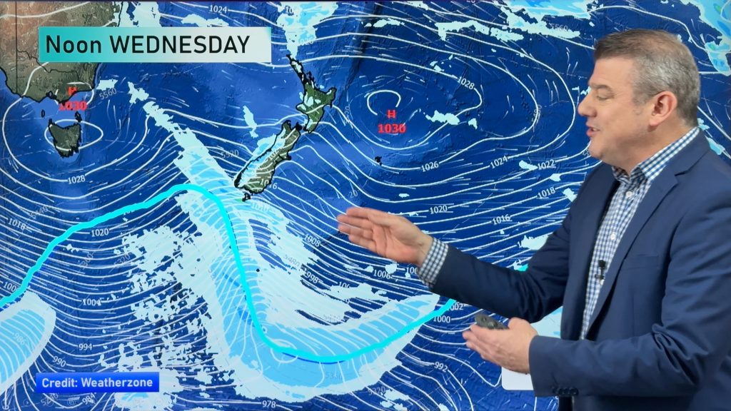
A low out over the Tasman will be our weather-maker for the next several days.
The low will start to rotate a trough of low pressure across the country tomorrow. As early as tomorrow afternoon, the northern tip of the North Island could start to see some light showers. By tomorrow evening, those shower chances will move south into Auckland.
By the time Tuesday morning rolls around, almost all of the North Island will be getting wet.
At this time, heavy rain is a possibility. Government forecaster MetService says Northland, Northern Auckland, Coromandel Peninsula, western Bay of Plenty and Rotorua all run the risk of seeing rainfall heavy enough to warrant warnings. A low risk for heavy rain extends to the rest of Auckland, northeast Waikato and eastern Bay of Plenty. WeatherWatch.co.nz forecasters agree with MetService, but also feel that Taranaki should be on the lookout for heavy rainfall Tuesday evening.
The low and its associated trough (also sometimes called a boundary) will continue to drift south on Wednesday. That means rain chances will spread onto parts of the South Island. The West Coast and Nelson could see some rain. But other than a few light showers early on Wednesday, the eastern side of the island will probably see very little, if any rain.
Thursday could bring some small rain chances to most of the North Island. The South Island may see some light rain along the West Coast. Light rain is possible on the other side of the island as well. During the night, the rain may change to snow in the higher elevations.
Light rain or snow will continue to be possible for eastern Otago on Friday. Snow levels will likely stay above 400m. Some light rain is also possible for Marlborough. Otherwise, the South Island should be fairly settled. Much of the North island will still be feeling the effects of the slow-moving Tasman low as it starts to push ashore. The whole island will see a chance for showers with the best chance being about Auckland, the Coromandel Peninsula and the Bay of Plenty.
By WeatherWatch Analyst Howard Joseph
Comments
Before you add a new comment, take note this story was published on 1 Jul 2012.


Add new comment
Geoff on 1/07/2012 9:28am
[As early as tomorrow afternoon, the northern tip of the North Island could start to see some light showers]
According to the rain radar, it’s been raining continuously all day Sunday, from Kaikohe northward. Not just light stuff either, it’s been quite heavy for much of the day.
Reply
WW Forecast Team on 1/07/2012 9:53am
But I was counting on a break in the at some point tonight and then lasting into tomorrow morning.
Today’s rain was caused by the outgoing system. Tomorrow’s rain will be from the incoming system.
Cheers, Howard
Reply
Duncan on 1/07/2012 8:11am
Hmm, I don’t think “suddenly” works for me either.
It isn’t “suddenly” as the forecasts have been predicting this for days.
Also your forecast mentions “as early as tomorrow afternoon,the northern tip of the north island could see some light showers”.
Hello up here in the “tip” it has been raining most of the day….Today!!.
Cheers
Duncan
Reply
WW Forecast Team on 1/07/2012 8:32am
However, please remember that we do forecasts for the entire country. The weather across most of New Zealand today was quite settled.
And the word "suddenly" does not refer to a "sudden" change in the written forecast. It refers to a rapid and marked change in the weather conditions that will be felt. Most of the North Island will see a huge change between Monday and Tuesday.
Cheers, Howard
Reply
Guest on 1/07/2012 5:58am
We are one day into July and the heading is ‘July Suddenly Unsettles?
Reply
WW Forecast Team on 1/07/2012 6:09am
My point was that we are going to go from a couple of days of nice weather to a couple of days unsettled weather in short order. So July will go from settled to unsettled rather suddenly.
Reply