
> From the WeatherWatch archives
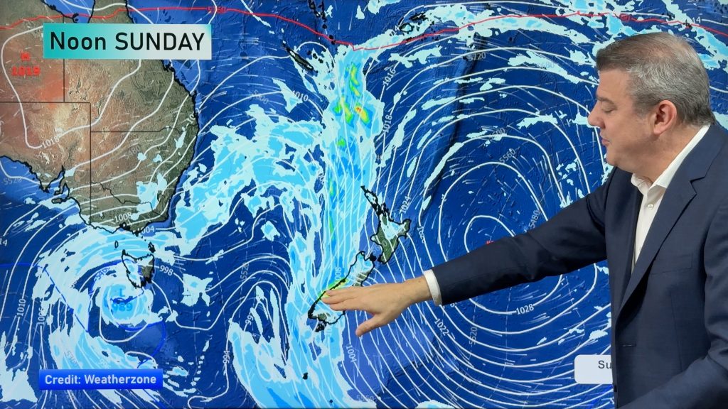
A low moves towards New Zealand from the west in the Tasman Sea on Tuesday, a warm then cold front move onto the South Island from evening.
Plenty of high cloud thickening over the North Island on Tuesday with east to northeasterly winds, a few patchy showers possible about the Bay Of Plenty and perhaps East Cape. The odd shower moves into the area between Taranaki and Wellington from late afternoon or evening, some rain possible overnight.
High’s reaching into the mid 20’s for Northland in the afternoon.
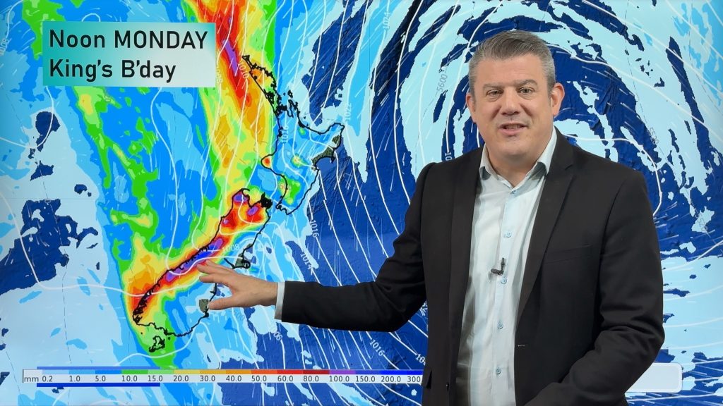
High cloud thickening for the east of the South Island, scattered rain spreads from the west evening onwards, becoming a little more persistent overnight. Nelson is cloudy from morning with areas of rain from afternoon, becoming heavy about the northwest Nelson ranges from evening then widespread heavy rain moves in overnight. Some heavy rain makes it into western Marlborough overnight also.
The West Coast sees cloudy skies, areas of rain move in towards midday then becoming heavy in the evening with the heaviest falls looking to be overnight about Greymouth northwards.
Southland sees mostly cloudy skies with the odd scattered area of rain. Winds mainly from the north or northeast for much of the South Island.
Blue – Heavy form of precipitation.
Purple – Strong winds.
Yellow – Temperatures around the mid 20 degree mark or over.

Not all regions and towns have been mentioned above. For specific 10 day information for your city, town, rural community or island please see the 1500 forecasts on our homepage!
– Aaron Wilkinson, WeatherWatch.co.nz
Latest Video
Heavy rain & gusty winds for parts of NZ this long weekend
The long weekend starts off mostly settled and dry, then subtropical north to north-west winds kick in with heavy West…
Related Articles
Heavy rain & gusty winds for parts of NZ this long weekend
The long weekend starts off mostly settled and dry, then subtropical north to north-west winds kick in with heavy West…
Latest on the long weekend weather
We still have another large high pressure zone to move over the nation, but subtropical northerlies will pick up this…
Subtropical northerlies and some wet weather chances going into the long weekend
More high pressure is moving over NZ this week but this week it slides east of us, creating subtropical northerlies…

