InfoGraphic: The Big Picture for Wednesday / Thursday
5/02/2019 6:00pm

> From the WeatherWatch archives
A ridge of high pressure starts to push over the South Island today meanwhile expect a southeasterly airflow for the North Island. An anticyclone to the east of New Zealand on Thursday directs an easterly quarter airflow over the country.
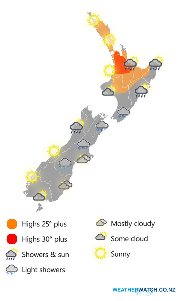
A few light showers spread northwards along the east coast of the North Island today, risk of a shower late afternoon / evening for the upper North Island otherwise a mainly sunny day beforehand. Areas of cloud for the lower western North Island, perhaps the risk of a shower or two also otherwise mainly dry. A mostly cloudy day for the eastern South Island, the odd light shower about especially morning. Some sun may break through from late afternoon about coastal areas and Southland / Otago. Mainly sunny for the West Coast, a few showers possible Greymouth northwards from afternoon.
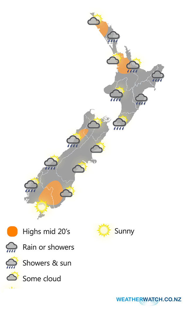
A few showers for the east coast of the North Island on Thursday, clearing from the south as the day moves along. Any other shower activity is mostly early morning for the rest of the North Island although a few may continue about eastern Northland for the rest of the day. The South Island is mostly sunny, any morning cloud in the east clears. A shower or two affects South Westland, more so from afternoon and perhaps up to Buller late afternoon / evening.
Wednesday
Thursday
WeatherWatch.co.nz
Latest Video

Matariki, the long weekend + the outlook for next week
Wet weather and cloud continues along the eastern side of the country with the heaviest rain now moving into northern…
Related Articles
Matariki, the long weekend + the outlook for next week
Wet weather and cloud continues along the eastern side of the country with the heaviest rain now moving into northern…

More eastern rain, but a drier long weekend coming
Rain continues today along the eastern South Island and lower North Island, coming in from the east with heavy falls….

More heavy rain, snow – but large dry areas, especially as we go into the long weekend
Heavy rain will continue for parts of Canterbury and Marlborough over the next day or two and it will gradually…

