
> From the WeatherWatch archives
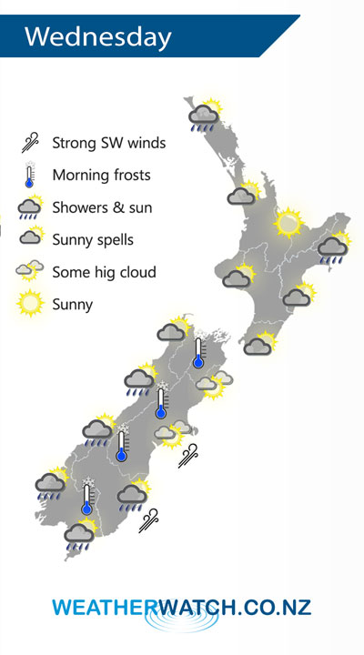
A ridge brings a period of settled weather for New Zealand on Wednesday, however not for long as a cold front pushes onto the lower South Island later in the afternoon.
Mostly sunny for the upper North Island on Wednesday, there may be a few clearing morning showers for Northland. Morning showers clear Hawkes Bay / Gisborne then sun increases. Mostly sunny in the west Taranaki southwards then cloud increases in the evening, rain moves in overnight.
Mostly sunny for a majority of the South Island with developing high cloud, morning frosts are possible especially for inland areas. Rain moves into Fiordland around midday then pushes northwards in the evening. Rain moves into Southland late afternoon then Otago in the evening, Canterbury overnight with gusty southwest winds, strong about the coast.
By Weather Analyst Aaron Wilkinson – WeatherWatch.co.nz
Latest Video

Matariki, the long weekend + the outlook for next week
Wet weather and cloud continues along the eastern side of the country with the heaviest rain now moving into northern…
Related Articles
Matariki, the long weekend + the outlook for next week
Wet weather and cloud continues along the eastern side of the country with the heaviest rain now moving into northern…

More eastern rain, but a drier long weekend coming
Rain continues today along the eastern South Island and lower North Island, coming in from the east with heavy falls….

More heavy rain, snow – but large dry areas, especially as we go into the long weekend
Heavy rain will continue for parts of Canterbury and Marlborough over the next day or two and it will gradually…

