
> From the WeatherWatch archives
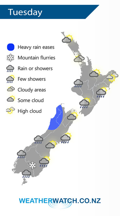
A cold front moves northwards over the North Island on Tuesday weakening as it goes, a cold southwest airflow lies over the South Island.
A band of rain / showers moves northwards over the North Island slowly during Tuesday, not reaching Auckland and Northland till the evening / overnight.
Early heavy rain eases about the northwestern corner of the South Island, expect showers for most other South Island regions although Canterbury and Marlborough are mainly dry. Canterbury could see a shower or two from afternoon Banks Peninsula northwards. A few sleety showers are to be expected about Southland with a few snow flurries to 400 or perhaps even 300m at times in a cold westerly airflow.
By Weather Analyst Aaron Wilkinson – WeatherWatch.co.nz
Latest Video

Cold fronts continue, wind & rain for some Fri/Sat
Wet weather is moving over the North Island today, while the South Island has drier skies – ahead of another…
Related Articles
Cold fronts continue, wind & rain for some Fri/Sat
Wet weather is moving over the North Island today, while the South Island has drier skies – ahead of another…

Cold fronts vs high pressure
A cold front is moving up NZ today and into Tuesday, but will fall apart as it heads north and…

Wintry change coming for SI and lower NI
Some wet weather, along with a drop in temperatures, will move into the lower South Island later on Sunday and…

