
> From the WeatherWatch archives
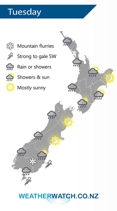
A southwesterly airflow lies over the country on Tuesday, a cold front moves onto the lower South Island in the morning then reaching the western North Island late afternoon / evening.
Showers for much of the western North Island on Tuesday, possibly heavy for a time late afternoon / evening. Mainly dry in the east after any early showers clear.
Rain or showers for much of the day along the West Coast of the South Island and about Southland, Otago has a dry start then a few showers move in during the afternoon. Snow flurries lower to low levels (200m) overnight.
By Weather Analyst Aaron Wilkinson – WeatherWatch.co.nz
Latest Video

Matariki, the long weekend + the outlook for next week
Wet weather and cloud continues along the eastern side of the country with the heaviest rain now moving into northern…
Related Articles
Matariki, the long weekend + the outlook for next week
Wet weather and cloud continues along the eastern side of the country with the heaviest rain now moving into northern…

More eastern rain, but a drier long weekend coming
Rain continues today along the eastern South Island and lower North Island, coming in from the east with heavy falls….

More heavy rain, snow – but large dry areas, especially as we go into the long weekend
Heavy rain will continue for parts of Canterbury and Marlborough over the next day or two and it will gradually…

