
> From the WeatherWatch archives
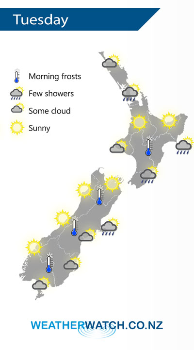
A cold southwesterly airflow eases further on Tuesday although it may still be fresh about eastern coastal areas in the morning. An anticyclone pushes in from the Tasman Sea covering most of New Zealand by afternoon.
Mainly sunny and or dry for western parts of the country on Tuesday, quite cold to start though especially for inland areas. The odd shower clears the Auckland region in the afternoon.
Morning cloud for Southland and Otago clears then mostly sunny, some cloud at times during the day for Canterbury with showers out on Banks Peninsula clearing during the afternoon. Showers about the Wairarapa and Mahia Peninsula ease during the day.
By Weather Analyst Aaron Wilkinson – WeatherWatch.co.nz
Comments
Latest Video

Matariki, the long weekend + the outlook for next week
Wet weather and cloud continues along the eastern side of the country with the heaviest rain now moving into northern…
Related Articles
Matariki, the long weekend + the outlook for next week
Wet weather and cloud continues along the eastern side of the country with the heaviest rain now moving into northern…

More eastern rain, but a drier long weekend coming
Rain continues today along the eastern South Island and lower North Island, coming in from the east with heavy falls….

More heavy rain, snow – but large dry areas, especially as we go into the long weekend
Heavy rain will continue for parts of Canterbury and Marlborough over the next day or two and it will gradually…


Guest on 17/06/2019 4:43am
drought breaker weather aye hahaha