InfoGraphic: The Big Picture for Thursday / Friday
8/05/2019 7:40pm

> From the WeatherWatch archives
Northerlies lies over New Zealand today, tending northwest over the South Island this evening as a front moves in. This front pushes over the North Island on Friday, westerlies further south.
Dry for most of the North Island then some rain moves into Taranaki from afternoon, possibly becoming heavy in the evening. Dry out east with high cloud, northerlies gusty through Cook Strait. Rain for the South Island’s West Coast may be heavy at times, more so from afternoon. Mainly dry in the east with some high cloud, a small area of low pressure may form about Otago bringing the chance of showers late afternoon / evening.

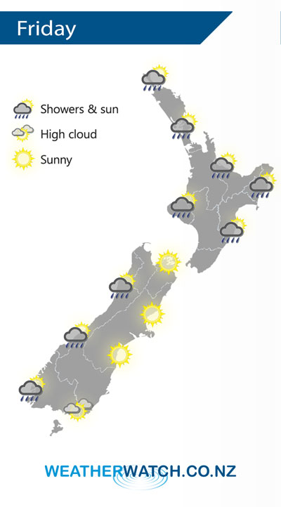
Morning rain for the western North Island on Friday then sunny areas increase from afternoon, some morning rain or showers for Hawkes Bay and Gisborne also then becoming mostly sunny after midday. The West Coast of the South Island has the odd shower at times during the day but many long dry periods also, mainly sunny in the east.
By Weather Analyst Aaron Wilkinson – WeatherWatch.co.nz
Latest Video

Matariki, the long weekend + the outlook for next week
Wet weather and cloud continues along the eastern side of the country with the heaviest rain now moving into northern…
Related Articles
Matariki, the long weekend + the outlook for next week
Wet weather and cloud continues along the eastern side of the country with the heaviest rain now moving into northern…

More eastern rain, but a drier long weekend coming
Rain continues today along the eastern South Island and lower North Island, coming in from the east with heavy falls….

More heavy rain, snow – but large dry areas, especially as we go into the long weekend
Heavy rain will continue for parts of Canterbury and Marlborough over the next day or two and it will gradually…

