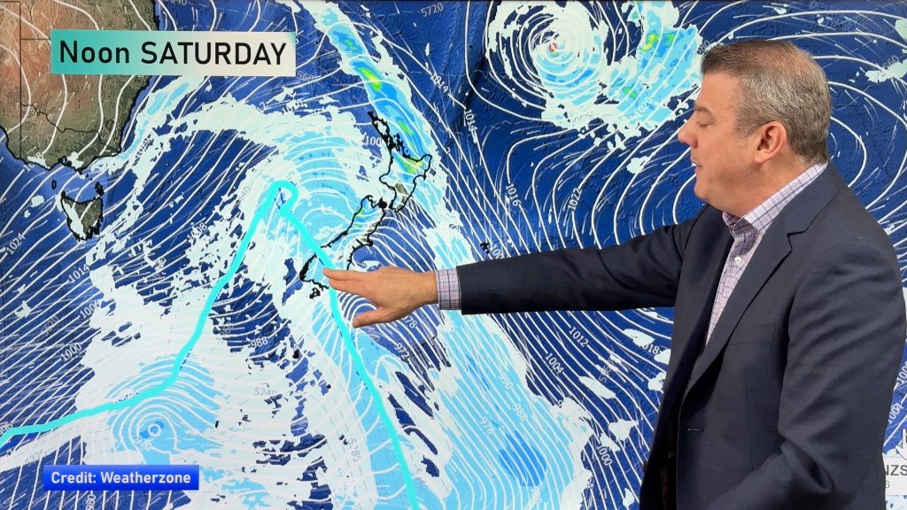
InfoGraphic: The Big Picture for Saturday / Sunday
13/12/2019 6:11am

> From the WeatherWatch archives
This weakening front moves over the North Island on Saturday, expect a northwesterly airflow further south. A front and low combination moves over the South Island on Sunday, northwesterlies further north.
A period of showers for the upper North Island in the morning on Saturday, the Bay Of Plenty may see showers move through more in the afternoon. A chance as showers move across East Cape in the afternoon they could turn thundery. Mainly dry for the lower North Island. Mostly cloudy for the West Coast of the South Island, some rain for Fiordland and the odd shower further north. Morning cloud in the east breaks to sunny areas and some high cloud.
Sunny areas and some cloud for the upper North Island on Sunday, the odd isolated shower possible from afternoon, a chance showers may turn thundery for Northland. Mostly sunny in the east with some high cloud. Rain with heavy falls moves northwards along the West Coast of the South Island during the day, rain about Southland moves into Otago during the afternoon with a southwest change. Sunny areas and some high cloud for Canterbury through to Nelson in the east.

By Weather Analyst Aaron Wilkinson – WeatherWatch.co.nz
Comments
Before you add a new comment, take note this story was published on 13 Dec 2019.


Add new comment