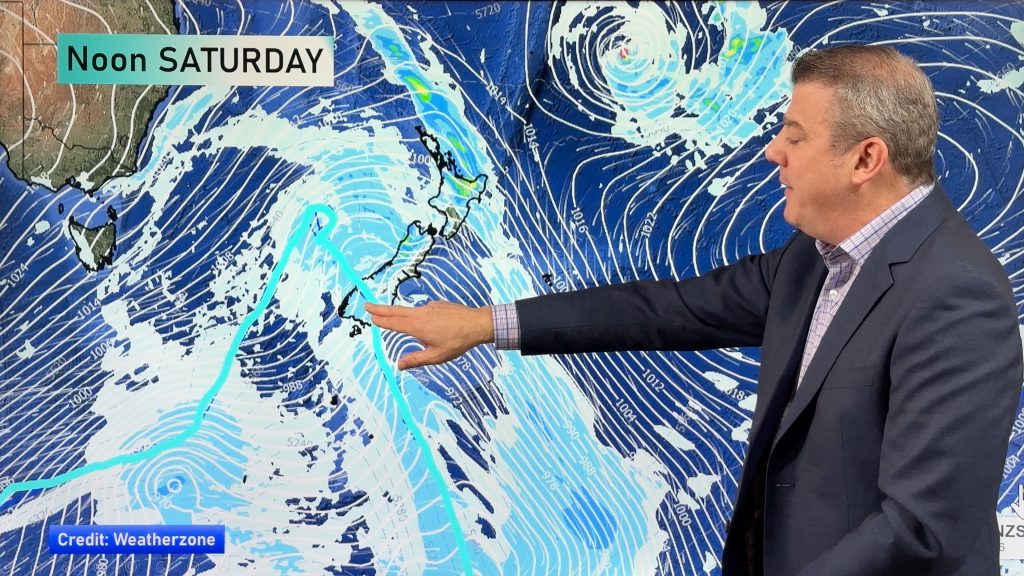
InfoGraphic: The Big Picture for Saturday / Sunday
20/03/2020 1:46am

> From the WeatherWatch archives
A low and associated front in the Tasman Sea moves over South Island on Saturday, the North Island is mainly settled. This front moves over the North Island on Sunday, expect a west to southwesterly airflow further south.
A mix of sun and cloud for the western North Island on Saturday, risk of a shower at times otherwise mainly dry, overnight showers are more likely from Taranaki through to Wellington. Morning cloud in the east breaks then expect some sun and high cloud. Heavy rain about South Westland pushes into North Westland during the afternoon then clearing at night. Scattered rain about Southland and Otago clears in the evening, spots of rain spread into Canterbury during the afternoon. Rain moves into Nelson in the evening then a few spots spread into Marlborough later on.
Rain or showers for the western North Island on Sunday, Northland may stay fairly dry till later in the evening or overnight. Drier conditions further east. The South Islands West Coast continues to see showers for much of the day, longer dry spells at times from afternoon. Generally dry in the east with some high cloud, morning showers clear Southland.

By Weather Analyst Aaron Wilkinson – WeatherWatch.co.nz
Comments
Before you add a new comment, take note this story was published on 20 Mar 2020.


Add new comment