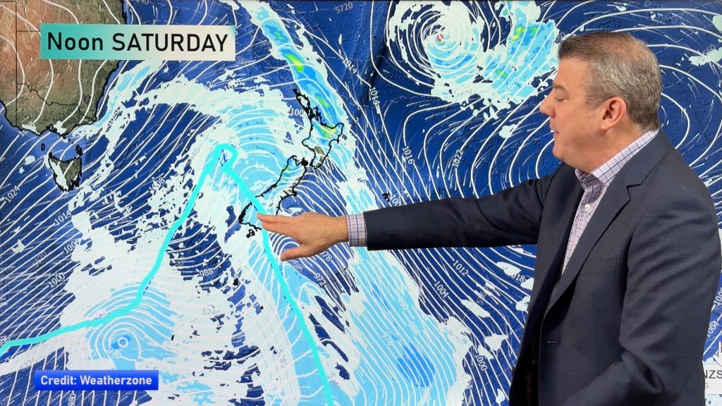
InfoGraphic: The Big Picture for Friday / Saturday
19/03/2020 6:00pm

> From the WeatherWatch archives
Southwesterlies lie over the country today then ease later on as a ridge moves in from the Tasman Sea. This ridge gets shunted out of the way on Saturday as a low and associated front in the Tasman Sea move into the western South Island, the North Island is mainly settled.
Showers for the western North Island today, mainly dry out east to start however southerlies bring the odd shower to the east coast from afternoon reaching Hawkes Bay / Gisborne this evening. Morning showers clear the West Coast of the South Island then sunny areas increase. Cloudy areas about coastal Otago may bring a morning shower then drying out from afternoon, Central Otago is mostly sunny after some morning cloud. Canterbury see southerlies freshen this morning bringing some cloud and the odd shower then drying out this evening.
A mix of sun and cloud for the western North Island on Saturday, risk of a shower at times otherwise mainly dry, overnight showers are more likely from Taranaki through to Wellington. Morning cloud in the east breaks then expect some sun and high cloud. Heavy rain about South Westland pushes into North Westland during the afternoon then clearing at night. Scattered rain about Southland and Otago clears in the evening, spots of rain spread into Canterbury during the afternoon. Rain moves into Nelson in the evening then a few spots spread into Marlborough later on.

By Weather Analyst Aaron Wilkinson – WeatherWatch.co.nz
Comments
Before you add a new comment, take note this story was published on 19 Mar 2020.


Add new comment