Heavy showers and a westerly change – The Big Picture on Wednesday
24/05/2016 5:00am

> From the WeatherWatch archives
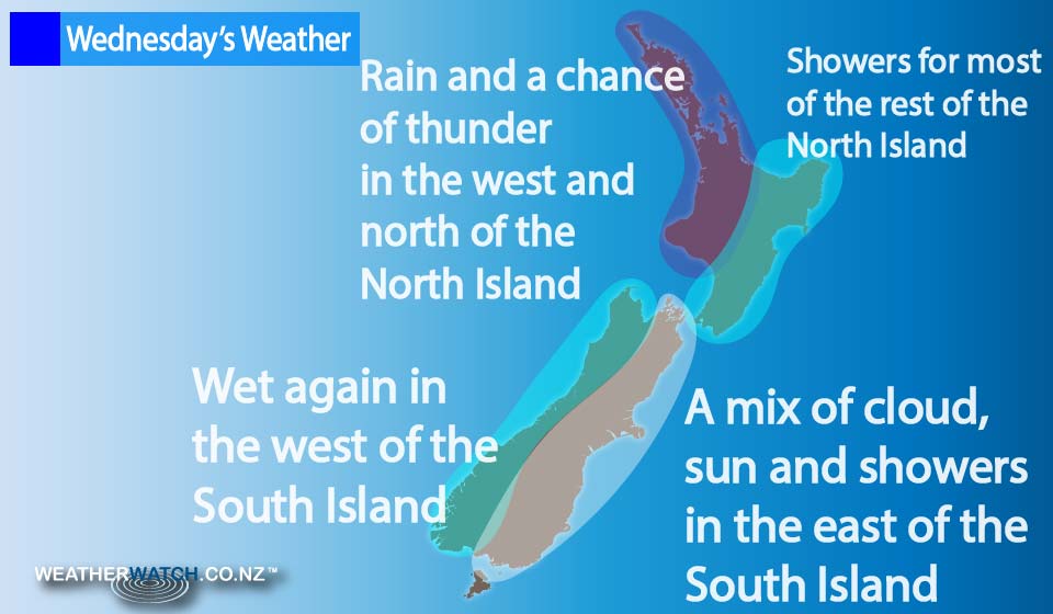
Another front is making its way over the country on Wednesday, bringing rain, squalls, winds and the possibility of thunderstorms in places.
There are showers for much of the North Island – some of these becoming heavy, squally (and thundery) at times during the afternoon and into evening.
Gusty northwesterlies change to the west late in the day.
The East Coast sees sunny areas and some high cloud, with the chance a spot of rain spreads from the west at times – otherwise mainly dry.
Showers remain for the west of South Island for much of the day, while morning rain about Buller could possibly be heavy, then ease to showers in the afternoon, along with west to southwest winds.
The east coast of the South Island sees some early showers clear, then mostly sunny conditions with light winds.
Southland and Otago see some morning sun, then showers from afternoon as northerlies change westerly.
Coastal Otago stays mainly sunny for much of the day, though high cloud thickens in the evening, bringing a few spots of rain along with it.
– Aaron Wilkinson & Drew Chappell, WeatherWatch.co.nz
Latest Video

Matariki, the long weekend + the outlook for next week
Wet weather and cloud continues along the eastern side of the country with the heaviest rain now moving into northern…
Related Articles
Matariki, the long weekend + the outlook for next week
Wet weather and cloud continues along the eastern side of the country with the heaviest rain now moving into northern…

More eastern rain, but a drier long weekend coming
Rain continues today along the eastern South Island and lower North Island, coming in from the east with heavy falls….

More heavy rain, snow – but large dry areas, especially as we go into the long weekend
Heavy rain will continue for parts of Canterbury and Marlborough over the next day or two and it will gradually…

