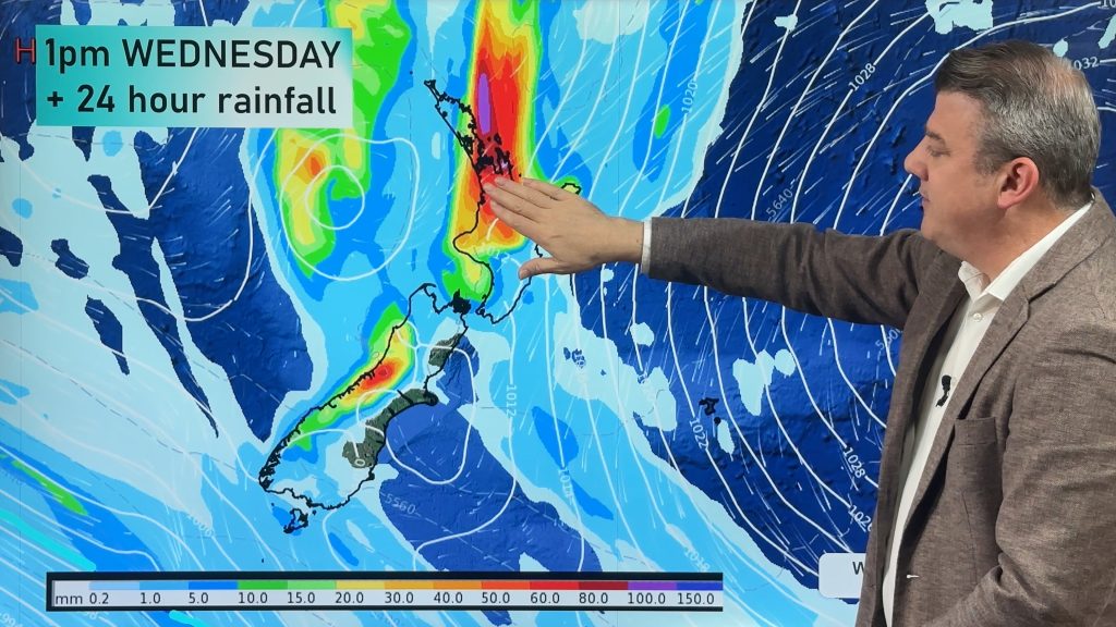
New Zealand’s weather is coming in from a number of directions over the coming week as large high pressure east of NZ combines with both a subtropical flow and a westerly flow to drive in heavy West Coast rain and pockets of heavy rain in the upper North Island.
The main time frame for wet weather is between now and Thursday morning, with a surge of gusty nor’westers today (potentially severe gale for a time through the Southern Alps).
But high pressure returns to NZ over the coming week, but that may also cause some daytime showers or downpours in a few northern and inland locations.
The polar boundary also briefly returns to the lower South Island – nothing major but a dip in temperatures coming.
We also have your 7 day rainfall map to make sense of it all. You can find these rainfall maps in the free WeatherWatch app or here.
Latest Video

Update on incoming cold change for NZ
High pressure still covers NZ but that will slide offshore as we go into Friday and the weekend as a…
Related Articles
Update on incoming cold change for NZ
High pressure still covers NZ but that will slide offshore as we go into Friday and the weekend as a…

Wintry blast coming this weekend, everyone will feel the temperature drop
A significant cold change is coming in this weekend, starting as early as Friday for the lower South Island and…

Tracking the showers & a potential wintry blast late next week
NZ is on the edge of high pressure with anticyclones moving through at times over the next several days bringing…

