Friday’s national forecast – Frosty and settled
26/05/2022 12:01pm
> From the WeatherWatch archives
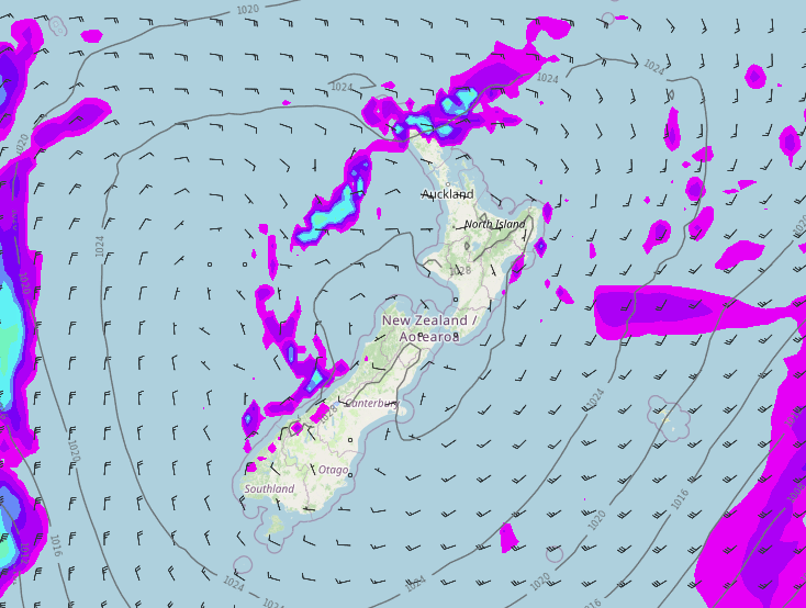
A high pressure system brings frosty and settled weather to New Zealand today, there will be showers north of Auckland though and the odd one for the West Coast. A few showers along the coastal fringe of the eastern North Island gradually break away.
Northland, Auckland, Waikato & Bay Of Plenty
Auckland northwards is looking a little cloudy, showers moving through north of Auckland into Northland especially in the east. Sunnier weather further south with frosty conditions first thing inland away from the coast. East to southeasterly winds.
Highs: 14-18
Western North Island (including Central North Island)
Sunny, frosty to start especially inland. Light southeasterlies die away.
Highs: 10-14
Eastern North Island
A few showers along the coastal fringe clear away in the morning, sunny spells start to break through from morning inland then nearer the coast from afternoon. Southwesterly winds gradually die away.
Highs: 12-14
Wellington
Morning cloud breaks away then sunny, light southerlies tend to the north in the afternoon.
Highs: 13-14
Marlborough & Nelson
Sunny after a frosty start, light winds.
Highs: 12-15
Canterbury
Sunny after a frosty start, especially inland. Light winds tending northeast near the coast.
Highs: 8-14
West Coast
A mix of sun and cloud, there may be a shower or two along the coastal fringe, reaching Fiordland in the evening. Light winds.
Highs: 11-14
Southland & Otago
Sunny after a frosty start, especially inland. Light winds.
Highs: 10-12
Latest Video

Frosts, late week rain & another cold weekend coming
High pressure will cross NZ over the next few days meaning more cold nights/mornings with frosts, but a nor’wester will…
Related Articles
Frosts, late week rain & another cold weekend coming
High pressure will cross NZ over the next few days meaning more cold nights/mornings with frosts, but a nor’wester will…

NZ: Cold & windy, then calm & frosty
Downpours, some squally with the chance of thunderstorms and even small tornadoes are possible for parts of NZ over Friday…

WeatherWatch App launches real-time local lightning tracker
A bolt out of the blue! WeatherWatch has launched a live, real-time lightning tracker, enabling Kiwis to gain access to data provided by the…

