
> From the WeatherWatch archives
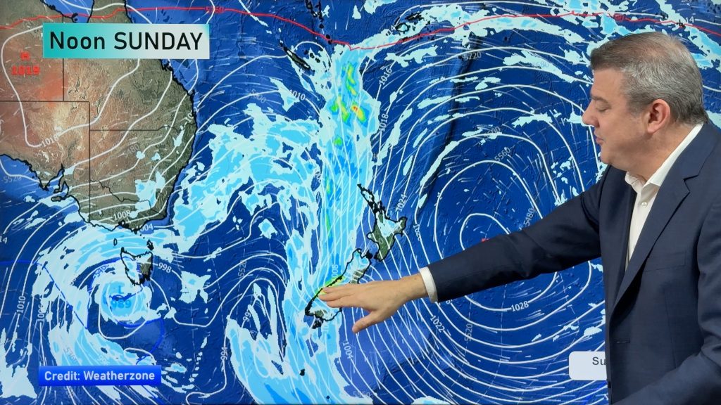
Ex Cyclone Cook slinks southwards down the eastern side of the South Island today, as it moves southwards expect a northwesterly airflow for the rest of New Zealand.
Northland, Auckland, Waikato & Bay Of Plenty
Sunny spells and occasional showers, especially afternoon then easing in the evening. Northwesterly winds.
Highs: 21-23
Western North Island (including Central North Island)
Any early rain eases to the odd shower and sunny spells, rain again from evening about Taranaki with heavy falls and thunderstorms possible especially right on the coast. Dry areas more frequent about the Manawatu during the day. Northwesterly winds.
Highs: 19-22
Eastern North Island
Mostly sunny with breezy north to northwesterly winds.
Highs: 22-24
Wellington
Early rain eases, perhaps mostly clearing then sunny areas breaking through, later in the evening there may be some further rain. Strong to gale northerly winds at first then easing.
High: 18
Marlborough & Nelson
Early rain clears then sun breaking through in the afternoon, later in the evening a few spells of rain may move in spreading from the west. Winds brisk to strong from the north.
Highs: 19-20
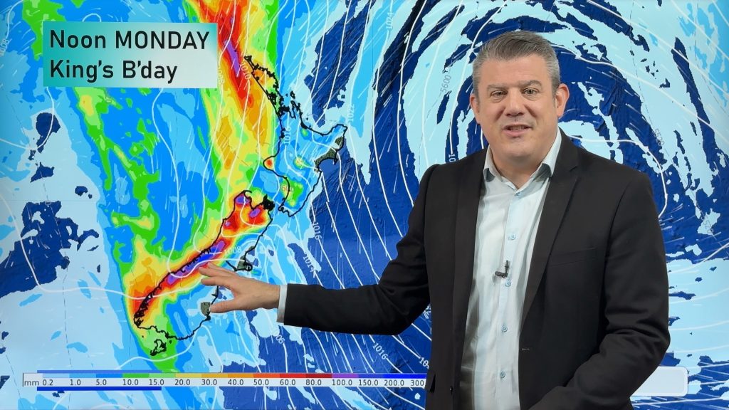
Canterbury
Morning heavy rain eases then clears in the afternoon as gusty strong southerlies change northerly. Skies remaining fairly cloudy.
Highs: 17-20
West Coast
Rain with heavy falls at times, breezy northerly winds. Winds tend west to southwest about Fiordland.
Highs: 16-17
Southland & Otago
Showers or some rain, easterly winds change southwest late afternoon. Rain about coastal Otago is heavy at times then easing overnight.
Highs: 15-17
By Weather Analyst Aaron Wilkinson – WeatherWatch.co.nz
Comments
Latest Video
28/05/2026 12:31am
Heavy rain & gusty winds for parts of NZ this long weekend
The long weekend starts off mostly settled and dry, then subtropical north to north-west winds kick in with heavy West…
Related Articles
28/05/2026 12:31am
Heavy rain & gusty winds for parts of NZ this long weekend
The long weekend starts off mostly settled and dry, then subtropical north to north-west winds kick in with heavy West…
26/05/2026 11:44pm
Latest on the long weekend weather
We still have another large high pressure zone to move over the nation, but subtropical northerlies will pick up this…
26/05/2026 12:12am
Subtropical northerlies and some wet weather chances going into the long weekend
More high pressure is moving over NZ this week but this week it slides east of us, creating subtropical northerlies…


Melissa on 13/04/2017 4:09pm
Hi WW was wondering if there was a possibility Cook could join other low on western side of South Island that has been hanging around and cause trouble?
WW Forecast Team on 13/04/2017 5:30pm
Hi Melissa
Current computer guidance says no (Little Britain anyone? lol).
But yes suffice to say it’s not looking to happen, the low that once was TC Cook wants to descend south of New Zealand then away to the east during the course of this weekend 🙂
Aaron