Early Summer? Warmer than average airflows may dominate NZ for weeks (+7 Maps)
27/11/2019 3:45am

> From the WeatherWatch archives
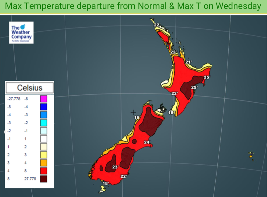
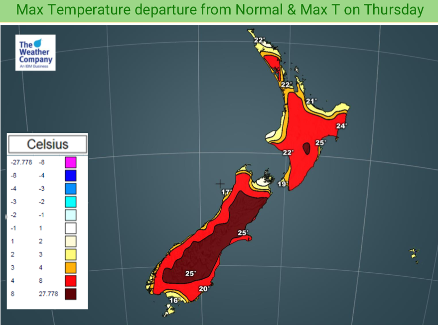
Parts of New Zealand have had five days with temperatures several degrees above normal and this may continue on. Latest forecasts show temperatures continuing like this into next week with highs into the early 30s and below normal rainfall for some distracts.
WeatherWatch.co.nz says some parts of New Zealand are caught up in the big dry from Australia with high pressure blocking rainmakers from moving into all parts of the country. This same belt of high pressure is also encouraging the warmer airflows.
As a very large area of low pressure engulfs the Southern Ocean skies south of NZ and Aussie next week, high pressure should stay stuck over the top of NZ bringing more dry weather into eastern areas and keeping warmer than normal west to north west airflows moving through.
While the odd day will be cooler and winds may locally be from any direction, the general theme for most of NZ is to continue warmer than normal by day as we head through the end of November, the first week of December and possibly through the second week too. Some in the south, like the West Coast and coastal Southland may have some briefly cooler winds, but more days look warmer than colder.
Here are some maps showing the general airflows. This may alter to some degree over the days and weeks ahead as forecasts fine tune the shape and size of the lows and highs (and therefore wind flows, directions, speeds etc). But it does paint a general idea of warmer than usual airflows from north of NZ, especially for the North Island. Some might call this set up an early summer even.
TUESDAY NOV 26:
THIS FRIDAY NOV 29:
NEXT TUESDAY 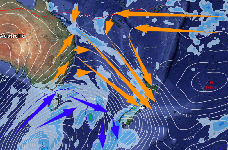
NEXT FRIDAY (DEC 6)

– WeatherWatch.co.nz
Latest Video

Wintry burst of weather: Snow, squally showers then sunshine & frosts
A polar change (another one!) arrives on Friday for the South Island and goes nationwide on Saturday, leaving NZ under…
Related Articles
Wintry burst of weather: Snow, squally showers then sunshine & frosts
A polar change (another one!) arrives on Friday for the South Island and goes nationwide on Saturday, leaving NZ under…

Antarctic southerly for parts of NZ Fri & Sat
For the first time this year a southerly from off Antarctica is heading towards the South Island, followed by more…

Meteors – Your Eyewitness Reports!
WeatherWatch.co.nz receives meteor reports from all over New Zealand and the globe, 24/7/365. **CASUAL COMMENTS**If you’ve seen something in the…

