Cold air moving up NZ, winds increasing again – the latest Maps (x6)
3/08/2019 11:14pm

> From the WeatherWatch archives
Colder air is moving up the country with snow lowering in the South Island and hail showers and squalls moving up the western side of both main islands.
Westerlies are turning south west today across New Zealand and the big blast of polar air will make for a colder than average Sunday in the South Island and and colder than normal day across much of the country on Monday.
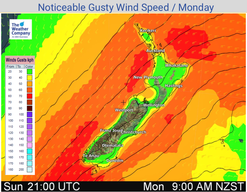
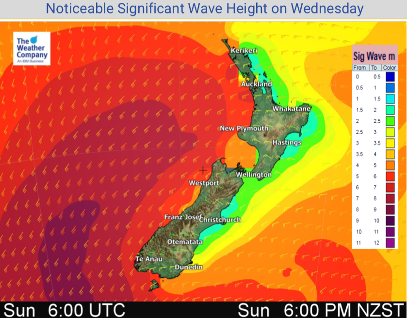
Winds are also increasing in strength over the next 24 hours across the country.
Here are the latest rain, snow, wind and wave maps to help make more sense of your local 10 day forecasts and how this polar blast is shaping up in your region…


– WeatherWatch.co.nz
Comments
Latest Video

Cold weekend, frosts return with high pressure, then a low late next week
The subantarctic airflow spreads over NZ today/tonight and into Saturday, dropping temperatures nationwide. Snow flurries are possible today to lower…
Related Articles
Cold weekend, frosts return with high pressure, then a low late next week
The subantarctic airflow spreads over NZ today/tonight and into Saturday, dropping temperatures nationwide. Snow flurries are possible today to lower…

Wintry burst of weather: Snow, squally showers then sunshine & frosts
A polar change (another one!) arrives on Friday for the South Island and goes nationwide on Saturday, leaving NZ under…

Antarctic southerly for parts of NZ Fri & Sat
For the first time this year a southerly from off Antarctica is heading towards the South Island, followed by more…


Guest on 4/08/2019 12:59am
Move along please
Weather of no interest in Wellington’
Partly cloudy but dandy
Does metservice know what to forcast?