> From the WeatherWatch archives
You won’t need a weather expert to tell you what’s on today’s weather maps. All you have to do is stand outside for a while.
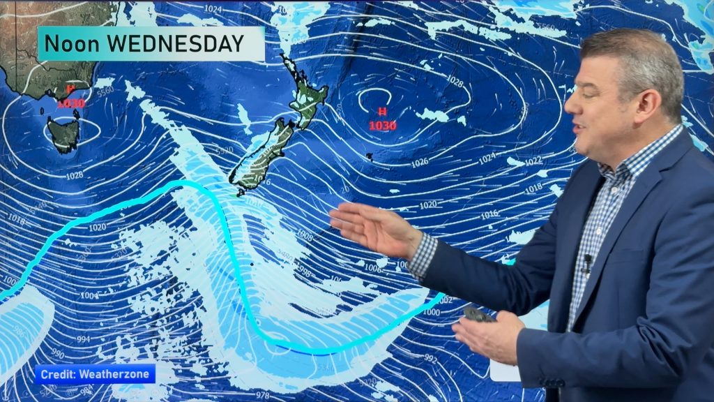
The increasing winds and the cooler air that are spreading across the country will let you know that we have a set of tightly packed isobars draped across New Zealand, as well as a rather potent cold front.
The question is; how do blustery conditions more reminiscent of autumn equate to a settled summer week ahead?
The tightly packed isobars that I mentioned earlier are the result of low pressure to our east and a strengthening high to our west. We are caught right in the middle where the sharp difference in pressure between the two systems is felt the most.
But this won’t last long.
As we go through the next few days, we will see the high move across the Tasman Sea and then into New Zealand. As it does, the tight pressure difference will relax, our winds will drop off and the high will settle our weather.
Because that’s what highs do. The sinking air associated with a high pressure ridge means that the air has a tough time rising to produce clouds and showers.
So, could it be that we have an entire week of nice weather ahead?
Well, this year that might be asking a bit much.
It looks like a frontal boundary will move on shore in the deep south on Friday. That could bring rain to the South Island on Friday which could then spill over onto the North Island on Saturday.
But if you are looking for 3-5 days worth of dry weather, this upcoming week is looking pretty good.
From WeatherWatch.co.nz
Photo by Mark Lcuas
Comments
Before you add a new comment, take note this story was published on 21 Jan 2012.


Add new comment