A weak high and the cyclone – The Big Picture on Tuesday
11/01/2016 4:34am

> From the WeatherWatch archives
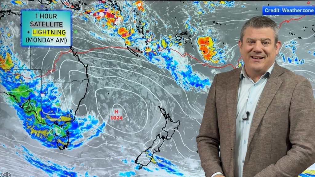
Tuesday is looking like a mix of sun, cloud and a few showers here and there – while the remnants of Tropical Cyclone Ula brush past our northeast.
We have a weak high to the west of New Zealand in the Tasman Sea, as a northwesterly airflow builds over most of the country itself.
Ula sits to the north of the North Island, and while it’s looking to stay north of us, a rain band stretching out from the low gives rain or showers to northeastern parts of the North Island during the day.
It’s looking cloudy for most of the upper North Island, with morning spells of rain easing in the afternoon, and clearing in the evening.
The East Coast sees areas of cloud and northwest winds, as well as the odd spot of rain at times from late afternoon or evening.
Wellington is shaping up mostly cloudy during the day, with winds gusting strong from the northwest too.
Also looking cloudy for the West Coast of the South Island, though there will be showers about Fiordland from afternoon, then rain there in the evening.
Shaping up mostly sunny elsewhere in the lower South Island, along with light winds, though southerlies push into Southland late afternoon then Otago later in the evening, bringing a few showers.

– Aaron Wilkinson & Drew Chappell, WeatherWatch.co.nz
Comments
Before you add a new comment, take note this story was published on 11 Jan 2016.


Add new comment
Steve on 11/01/2016 7:18am
Hi Guys. I find it interesting that this particular Cyclone Ula has survived for as long as it has. It seems to have been hanging around for quite some time. If it flicks the North with a bit more moisture without any wind damage it will be most welcome.
Cheers Steve
Reply
WW Forecast Team on 11/01/2016 1:42pm
A chance this may happen but perhaps in the weekend, we’ll have to see how models play out.
WW
Reply