A burst of NE winds and rain for most regions, we break it down over 11 MAPS
14/07/2018 3:24am

> From the WeatherWatch archives
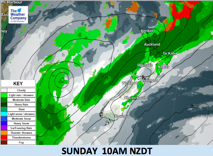
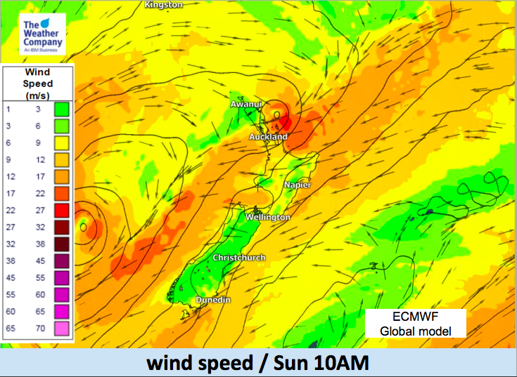
As a big high pressure system is slowly drifting off New Zealand a large developing low in the Tasman Sea moves in behind it – creating a “squash zone” of increasing north to north east winds nationwide and a period of rain with isolated heavy falls.
The band of rain moving slowly eastwards across the Upper North Island on Sunday may deliver localised rates of 30-50 mm in half a day, which means isolated areas of flooding is possible. The band of heavy rain looks fairly narrow but is slow moving due to the blocking large high still to New Zealand’s east (which also is feeding sub-tropical air in to the rain bands, helping give them more energy).
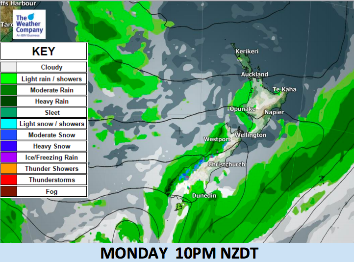
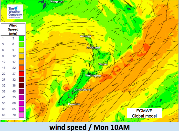
The blustery NE winds should ease to light winds or fairly calm for many places once that rain band has passed by.
For some in the east the rain may not arrive until tonight or even overnight.


– WeatherWatch.co.nz
Latest Video

NZ: 8 Day outlook as gales & rain ease, high pressure builds
Damaging wind gusts and heavy rain will continue to affect some parts of the North Island and brushing Marlborough today…
Related Articles
NZ: 8 Day outlook as gales & rain ease, high pressure builds
Damaging wind gusts and heavy rain will continue to affect some parts of the North Island and brushing Marlborough today…

Pockets of hit & miss heavy rain, snow moves northwards
Low pressure continues to slowly move across the upper North Island and for some that will bring the sun out,…

Slow go for northern low & southern cold
For the next few days low pressure will crawl over the upper North Island, driving in rain as far south…

