When will the daytime deluges and thunderstorms end? (+4 Maps)
27/11/2017 10:18pm

> From the WeatherWatch archives
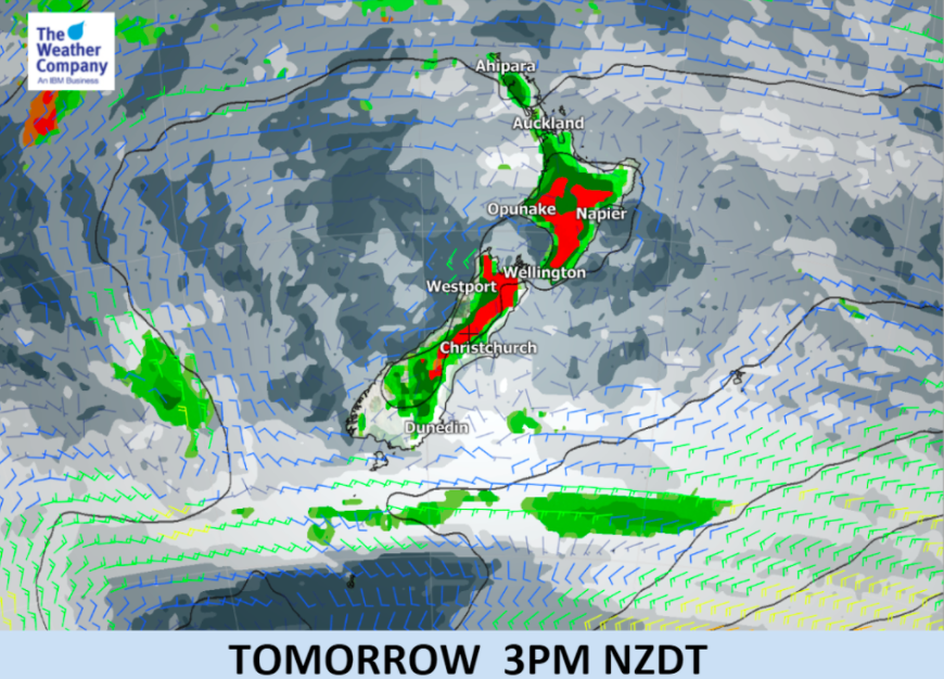
It’s hard to believe but the high causing our daily deluges and thunderstorms is wider than Australia and centred quite a distance east of New Zealand.
Long range computer models show the high is slowly edging eastwards but at the same time it continues to expand around the New Zealand area…so it’s moving and growing means no real change where we are.
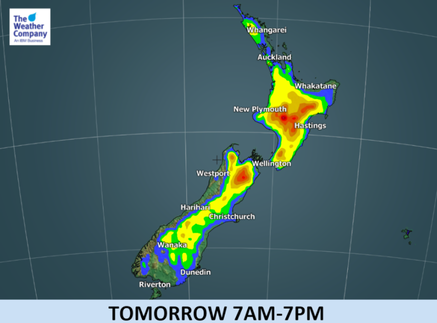
The forecast for the next 10 days shows more downpours coming, but they do shift around a bit.
In a nutshell, here’s what to expect (and please do use our Forecast Rain Maps as well to match up with the below, for more detail and understanding).
- TODAY/TUESDAY: High risk of downpours with thunder through inland areas of both islands, similar to yesterday.
- WEDNESDAY: A repeat of Tuesday.
- THURSDAY: Downpours shift a little further north, more into Waikato/Auckland/BOP in the North Island and more into the NW corner of the South Island.
- FRIDAY: Most downpours ease in the South Island, still a few random ones along the ranges. In the North Island Central Plateau, Waikato, Taranaki, Waitomo and Gisborne have risks.
- SATURDAY: Waikato, Coromandel Peninsula, BOP
- SUNDAY: Looks mostly dry in both islands. Only a couple isolated downpours across the entire country, most likely the Gisborne ranges.
- MONDAY: Downpours most likely around the Ruahine Ranges and the Canterbury foothills/ranges
- NEXT TUES: Central North Island.
Of course things might move around a bit but this is the general thinking.
It seems the biggest downpours will slide a little further north up both islands over the coming few days, which will allow heat to return to the lower South Island under sunnier skies (highs back up to 30 degrees later this week).
The northern shift will put far more people in the risk zones for downpours, especially as they form in or drift into regions like Waikato, Bay of Plenty and Auckland.


– InfoGraphics by The Weather Company (an IBM business and official WeatherWatch.co.nz partner)
– WeatherWatch.co.nz
Latest Video

Cold weekend, frosts return with high pressure, then a low late next week
The subantarctic airflow spreads over NZ today/tonight and into Saturday, dropping temperatures nationwide. Snow flurries are possible today to lower…
Related Articles
Cold weekend, frosts return with high pressure, then a low late next week
The subantarctic airflow spreads over NZ today/tonight and into Saturday, dropping temperatures nationwide. Snow flurries are possible today to lower…

Wintry burst of weather: Snow, squally showers then sunshine & frosts
A polar change (another one!) arrives on Friday for the South Island and goes nationwide on Saturday, leaving NZ under…

Antarctic southerly for parts of NZ Fri & Sat
For the first time this year a southerly from off Antarctica is heading towards the South Island, followed by more…

