
> From the WeatherWatch archives
There’s plenty of rain, wind and cold conditions in the forecast on Friday – with the weekend set to bring some more!
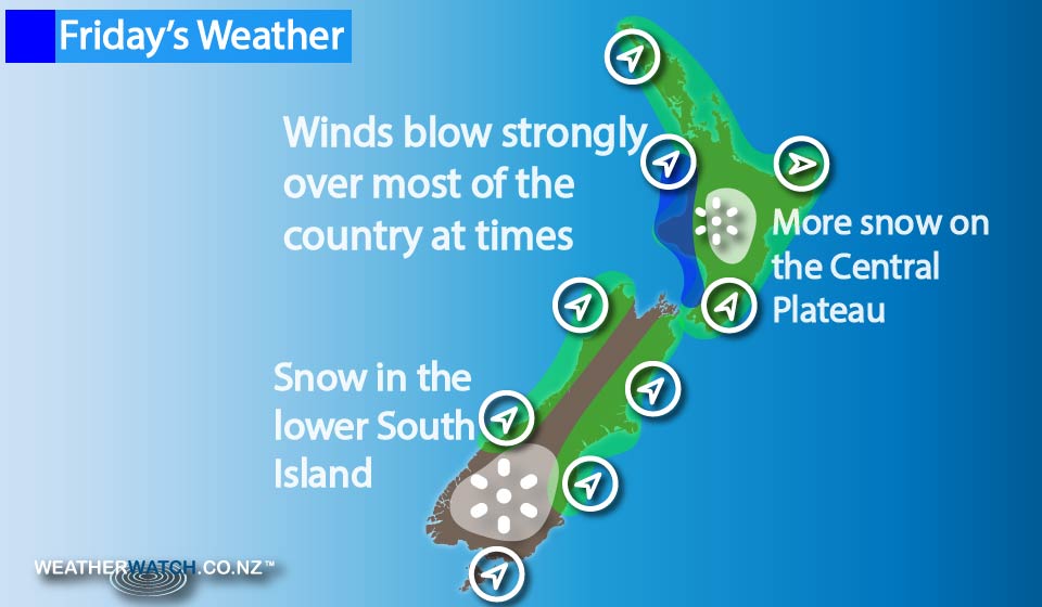
Showers turn to rain on the western side of the North Island, before easing back to showers again in the afternoon, as strong west to northwest winds change to the southwest.
Showers should have cleared for most areas by evening.
The East Coast sees a few showers drying up in the afternoon, while the Wairarapa may be dry in the morning, before the odd shower sets in from afternoon, and winds freshen from the southwest.
Further south, the West Coast, Canterbury, Marlborough and Nelson see areas of cloud and the odd shower, while many should remain fairly dry.
Winds blow cold from the southwest, before easing later in the day.
For Fiordland, Southland and Otago, cold showery weather eases up in the afternoon, and clears for most – although a shower or two may hang about some coastal areas till evening.
Morning snow falls on the Central Plateau down to around 700m and then clears, while in the South Island, snow flurries about Fiordland, Southland and Otago fall down to around 400m, and while they’re not heavy, they will be cold.
Things ease up by midday, and mostly clear – although a straggler may hang about Southland and the Catlins till evening.
– Aaron Wilkinson & Drew Chappell, WeatherWatch.co.nz
Latest Video

Wintry weather coming: Snow, rain, wind & sunshine
A cold front is moving into NZ from Friday to Sunday with low pressure developing west of NZ and then…
Related Articles

Polar airflow + northern low = pockets of heavy rain & snow
A colder change is coming – and so too is a large low which will develop and grow over northern…
Wintry weather coming: Snow, rain, wind & sunshine
A cold front is moving into NZ from Friday to Sunday with low pressure developing west of NZ and then…

ClimateWatch: JULY outlook & what El Niño means for NZ
El Niño is officially here and still getting stronger in the months ahead, but it’s harder to notice its effects…

