Wednesday’s Thunderstorm risks for New Zealand in Maps:
28/11/2017 9:49pm

> From the WeatherWatch archives
As of late morning downpours were again rapidly forming through inland areas of both islands with thunderstorms expected to kick off from lunchtime and peak yet again into the afternoon and evening.
Deluges, thunderstorms and even hail and flooding risks are all associated with these intense but slow moving storm cells.
The key difference with today compared to previous days is the fact that there’s a high risk of downpours in the upper North Island, including Northland and Waikato and parts of Auckland.
On Thursday the north may see even more downpours.


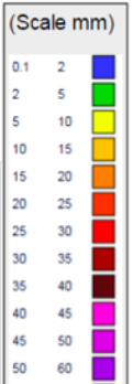
– Images by The Weather Company (an IBM business and an official WeatherWatch.co.nz business partner)
– WeatherWatch.co.nz
Latest Video

ClimateWatch: JULY outlook & what El Niño means for NZ
El Niño is officially here and still getting stronger in the months ahead, but it’s harder to notice its effects…
Related Articles
ClimateWatch: JULY outlook & what El Niño means for NZ
El Niño is officially here and still getting stronger in the months ahead, but it’s harder to notice its effects…

Low pressure heading to NZ this weekend & into next week
Many regions have settled weather at the moment with frosts as far north as Auckland this morning, but still some…

Colder nights/mornings, polar change coming Sun/Mon
The nights and mornings ahead will be colder in a number of regions – but an even colder change is…

