
> From the WeatherWatch archives
Two sets of weather are about to affect New Zealand – rain with sub-tropical connections in the North Island and a cold blast of air in the South Island.
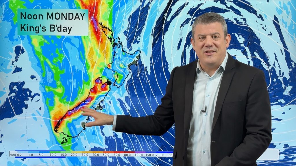
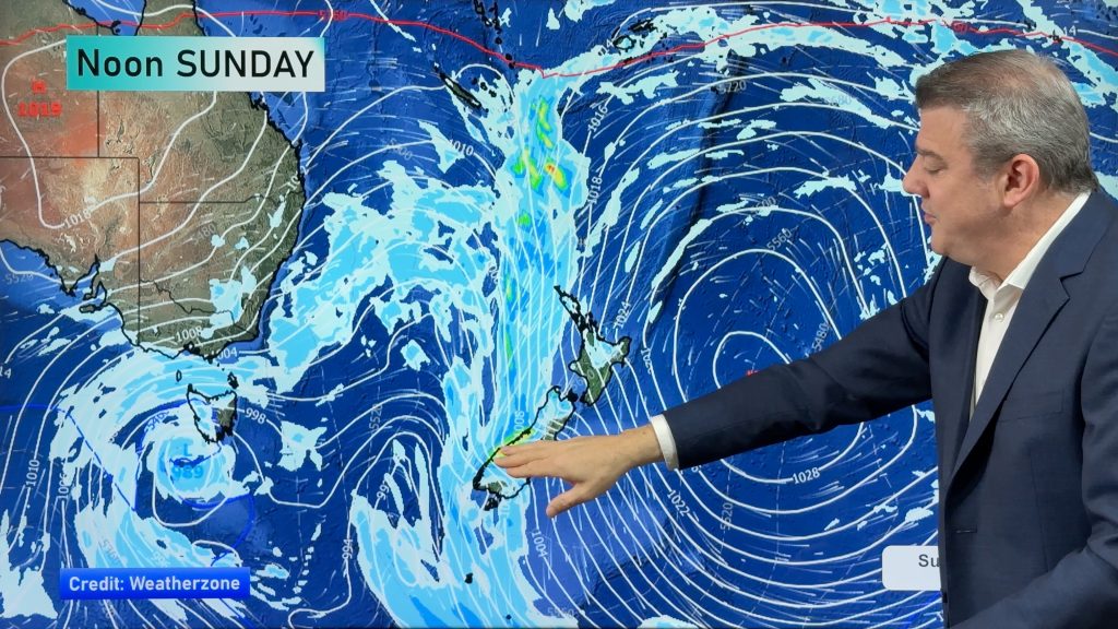
It’s a complicated set up, but generally speaking Sunday is the day the rain sets in over the North Island and the day the coldest air moves into the South Island.
We’ve told Civil Defence in Auckland this system may produce localised heavy falls (not just in Auckland but anywhere over the North Island to be honest) and while the chances of flooding are not currently high from this incoming event following the recent rains and floods there may be moderate concerns about further prolonged rain. Thankfully the nation has enjoyed some truly stunning, dry and sunny days since ex-Cyclone Cook passed so a lot of the water has been able to drain away or be absorbed deeper into the ground.
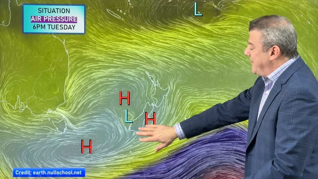
The cold snap won’t impact the North Island as much as it will the South Island, Monday will be cooler but nothing like the lower South Island will be on Sunday.
Places like Invercargill, Dunedin and Queenstown have daytime highs of only 9 degrees on Sunday. Well down from highs in the late teens or early 20s at the moment.
Things may briefly warm up again next week but another, possibly bigger, cold snap is coming later next week (for the first weekend of May potentially).
Welcome to true Autumn.
More details in our next weather video out this afternoon.

– Image Sunday morning shows cold southerlies in the south and plenty of wet weather over the north / weathermap.co.nz
– WeatherWatch.co.nz
Comments
Latest Video
Heavy rain & gusty winds for parts of NZ this long weekend
The long weekend starts off mostly settled and dry, then subtropical north to north-west winds kick in with heavy West…
Related Articles
Heavy rain & gusty winds for parts of NZ this long weekend
The long weekend starts off mostly settled and dry, then subtropical north to north-west winds kick in with heavy West…
Latest on the long weekend weather
We still have another large high pressure zone to move over the nation, but subtropical northerlies will pick up this…
Subtropical northerlies and some wet weather chances going into the long weekend
More high pressure is moving over NZ this week but this week it slides east of us, creating subtropical northerlies…


Guest on 27/04/2017 2:56am
Single digit highs? The last time you quoted that computer generated temp for the deep south on your site, it was wrong. 12 – 13 maybe…
WW Forecast Team on 27/04/2017 3:04am
Well 9 is very close to 10 so it’s certainly possible some areas will get into the low double digits. The possibility for some to only reach 9, or at least spend a great deal of the day in single digits, is there. Even if 12 or so the wind chill will make it feel single digits for those in exposed areas too… it will be cold either way! The southerly overall isn’t longlived for Southland though – the point of our story is that a cold snap is coming.
Cheers
WW
LM on 27/04/2017 10:44am
I consider a it a ‘cold snap’ if the southerly comes straight from Antartica. Might shock some of the plants that are now flowering when they shouldn’t be though!