The final weekend of winter promises more early spring weather (+6 Maps)
23/08/2018 11:41pm

> From the WeatherWatch archives
The mornings may be a little cool for some but generally speaking high pressure is rolling in this weekend and by Sunday many places will be sunny, dry and mild with a strong hint of spring in the air.
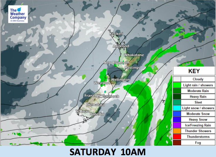
A period of settled weather is expected for most parts of the country from Friday to Tuesday next week, despite a few lingering showers on Saturday in coastal areas.
Temperature-wise and with high pressure rolling in following the fading south to south west winds the mornings and will be cooler and Saturday may not be overly warm for some South Island places. But daytime temperatures will gradually rise to normal values for September to October… here in late August. By Sunday and early next week some places will have double digit overnight lows and daytime highs several degrees above normal for this time of the year.
Weather at Eden Park before the Bledisloe Cup may see a few showers caught up in the sou’wester on Saturday itself but by kick off in the evening high pressure should be pushing in and easing the winds back further and clearing the showers. Take a jacket and check our hourly forecasts before leaving, just to be safe.
Have a great weekend, New Zealand!


– WeatherWatch.co.nz
Latest Video

NZ: 8 Day outlook as gales & rain ease, high pressure builds
Damaging wind gusts and heavy rain will continue to affect some parts of the North Island and brushing Marlborough today…
Related Articles
NZ: 8 Day outlook as gales & rain ease, high pressure builds
Damaging wind gusts and heavy rain will continue to affect some parts of the North Island and brushing Marlborough today…

Pockets of hit & miss heavy rain, snow moves northwards
Low pressure continues to slowly move across the upper North Island and for some that will bring the sun out,…

Slow go for northern low & southern cold
For the next few days low pressure will crawl over the upper North Island, driving in rain as far south…

