> From the WeatherWatch archives
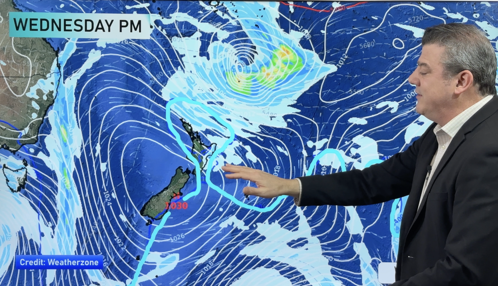
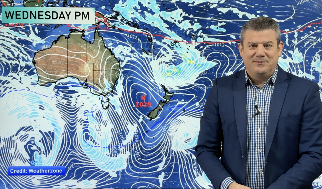
As WeatherWatch.co.nz forecast last month, the start of February would be unsettled with a couple chances of rain – and a burst of cooler air. We’re now at the end of this set up and a large high is rolling back in – which means a calmer, drier, hotter, pattern is about to return to most.
The tropics and sub-tropics are highly active now – as you’d expect now that we’ve passed the halfway mark for the cyclone season. However just as active (and actually more powerful) are the large highs tracking south of Australia, over New Zealand and east of New Zealand. On the northern side of these highs lies an ‘invisible wall of air pressure’ and this basically blocks the tropical rain makers from dropping south towards New Zealand.
Lows that do drop down are most likley between highs (as one high departs and the next one is still over Australia moving our way).
With that in mind – we don’t see a great deal of life rainwise for New Zealand over the next week or two.
In fact a large high may well remain firm over most of the country for the rest of February…which is why we are still very concerned about droughts being officially declared in some of our driest regions later this month.
As far as the Southern Ocean is concerned – higher pressure builds there over the next week or so too. This will also block southern fronts from moving northwards.
WeatherWatch.co.nz says the next ‘gap’ between highs arrives at the end of February – and start of March. Until then, isolated showers will be more likely in parts of New Zealand rather than any main rain bands.
We’ll continue our RainWatch updates – with more frequent updates likely later this month as dry weather sets back in again for many areas after a changeable start to February.
– WeatherWatch.co.nz
Comments
Before you add a new comment, take note this story was published on 9 Feb 2015.


Add new comment
peter on 10/02/2015 8:58pm
so if auckland and northland get rain and other lucky places you dont need them any more….what a bout the areas that didnt get much rain!!!!!!!!!
peter
Reply