Northwest winds come again – The Big Picture on Wednesday
20/10/2015 4:00am

> From the WeatherWatch archives
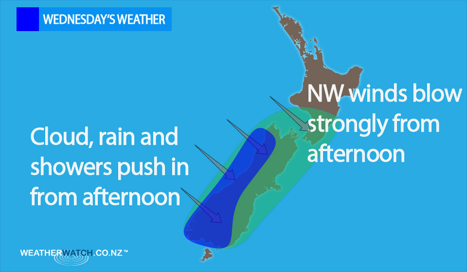
On Wednesday we have an anticyclone situated to the north of New Zealand, while a northwesterly airflow strengthens over the country.
This is becoming especially strong from afternoon about the South Island, as well as parts of the lower North Island.
In the evening, a southwest change moves into Southland, before pushing northwards later in the evening and then overnight.
For the most part, we can expect sunny weather in the east of the country with warm weather, and high cloud later in the day.
Winds are strong from the northwest, with gales possible from afternoon about the South Island in the east – and about Cook Strait.
It’s looking cloudy in the west of the South Island, with showers then rain which pushes northwards later in the day, and heavy falls later on.
Cloudy areas for the west of the North Island, with the chance of the odd light shower, otherwise mainly dry.
Southwesterlies that push into Southland late afternoon and evening brings rain.
– Aaron Wilkinson & Drew Chappell, WeatherWatch.co.nz
Latest Video

Matariki, the long weekend + the outlook for next week
Wet weather and cloud continues along the eastern side of the country with the heaviest rain now moving into northern…
Related Articles
Matariki, the long weekend + the outlook for next week
Wet weather and cloud continues along the eastern side of the country with the heaviest rain now moving into northern…

More eastern rain, but a drier long weekend coming
Rain continues today along the eastern South Island and lower North Island, coming in from the east with heavy falls….

More heavy rain, snow – but large dry areas, especially as we go into the long weekend
Heavy rain will continue for parts of Canterbury and Marlborough over the next day or two and it will gradually…

