Next 2 days: Mostly dry, hot & sunny – but some rain later on Friday (+2 Maps)
5/12/2017 9:04pm

> From the WeatherWatch archives
The spell of drier and warmer than usual weather continues for the next couple of days (at least) but a band of rain is coming from Australia to the West Coast.
WeatherWatch.co.nz forecasters say the West Coast is most exposed to rain, starting late on Friday and peaking on Saturday before easing and clearing Sunday. The chance for rain in the North Island is much lower on Sunday, but some showers, drizzle and isolated downpours are possible here and there.
Over the next couple of days the heat may increase even further. Daytime highs on Thursday through Central Otago may reach 35 degrees C in some places.
Here’s the latest for the next two days:

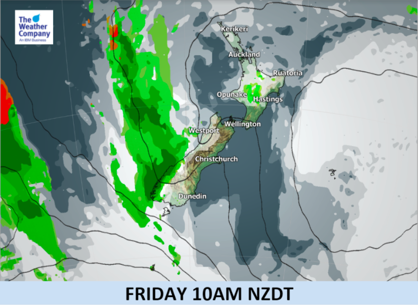

– Infographics by The Weather Company (An IBM business and an Official WeatherWatch.co.nz Business Partner).
– WeatherWatch.co.nz
Comments
Before you add a new comment, take note this story was published on 5 Dec 2017.
Latest Video

(VIDEO) NZ 7 Day: Variety in the weather, but Southern Ocean storms waking up
Low pressure moves in to NZ from the Tasman Sea this weekend and completely falls apart – bringing downpours and…
Related Articles
(VIDEO) NZ 7 Day: Variety in the weather, but Southern Ocean storms waking up
Low pressure moves in to NZ from the Tasman Sea this weekend and completely falls apart – bringing downpours and…

VIDEO: ClimateWatch: July is the month of BIG lows, BIG highs
This month around New Zealand, Australia and the region we see big highs and big lows – bringing decent stretches…

VIDEO: Severe weather risks for NZ as low moves in
Programming Note: Apologies but we have no video on Thursday – back again on Friday! – A storm in the…


Add new comment