
> From the WeatherWatch archives
Yesterday we tracked the cold front as it moved up New Zealand – with a clear line across the South Island showing temperatures dropping behind the front.
As we head through Wednesday afternoon it’s clear – the cold change has swept in nationwide.
Compare the current temperature map (below) with the one we showed you on Tuesday afternoon as the cold front moved north!
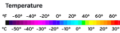
As of 12:30pm Wellington, Christchurch and Dunedin were all in single digits, around 8 or 9 degrees.
Wellington is especially exposed to the southerly, which is hovering around – or just under – gale force.
Conditions settled down and warm up over the next two days.
COMPARE TUESDAY TO WEDNESDAY!
TUESDAY:
WEDNESDAY (12:30pm):
– WeatherWatch.co.nz with Wunderground
Latest Video

Large low brings rain, downpours & some snow – gets colder as the week progresses
Low pressure will cross the upper North Island in the days ahead and that set-up actually pushes more heavy rain…
Related Articles
Large low brings rain, downpours & some snow – gets colder as the week progresses
Low pressure will cross the upper North Island in the days ahead and that set-up actually pushes more heavy rain…

WeatherWatch App launches real-time local lightning tracker!
A bolt out of the blue! WeatherWatch has launched a live, real-time lightning tracker, enabling Kiwis to gain access to data provided by the…

Polar airflow + northern low = pockets of heavy rain & snow
A colder change is coming – and so too is a large low which will develop and grow over northern…

