More rain, some snow, as large low pressure covers NZ (+4 Maps)
10/08/2019 7:32pm

> From the WeatherWatch archives
A very large low pressure system covers NZ with mild weather in the north and colder conditions in the south.
Some places in the south will actually warm up a little today while those further north stay warm, but colder air is coming in the days ahead for many places. Nothing major in the north but a reset back to normal. Windier weather is moving in for some places over the next few days too, as low pressure deepens south of NZ.
Snow flurries will affect inland parts of the South Island today and colder air flows remain stuck around the lower South island until mid week. While a colder air flow is surging north this week the good news is that the most polar of it will be too our east. Still, wind chills remain a bit tough for newborn livestock for the next few more days in some areas.
Isolated thunderstorms, squalls and hall are also moving in off the Tasman Sea ahead of the strong W to SW flow moving in,
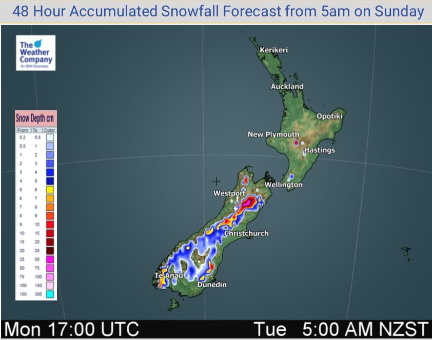
Here are some updated rain and snow maps for the next 48 hours.
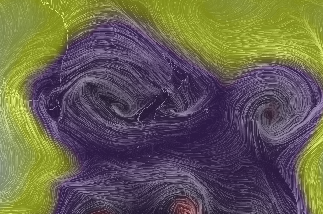 Latest air pressure map – low air pressure seen in purple.


– WeatherWatch.co.nz
Comments
Before you add a new comment, take note this story was published on 10 Aug 2019.
Latest Video

NZ VIDEO (7 Day): High pressure, frosts, expand as big lows surround us
Most of you will be pleased to know drier weather is coming for most parts of New Zealand. High pressure…
Related Articles
NZ VIDEO (7 Day): High pressure, frosts, expand as big lows surround us
Most of you will be pleased to know drier weather is coming for most parts of New Zealand. High pressure…

NZ: Frosts, high pressure, dry skies increasing – but what about next week?
Frosty weather is expanding this weekend with perhaps some of the coldest overnight weather the North Island has had so…

NZ VIDEO: Big frosts as high pressure flirts with NZ
A low will cross the North Island on Thursday while heavy frosts (-5C and below!) will affect inland parts of…


Add new comment
Guest on 11/08/2019 1:52am
Metservice in their wisdom of thunderstorm watches
every where except Wellington
We had Thunderstorms last night
Wellington does have Thunderstorms and will do tomorrow
Reply