
> From the WeatherWatch archives
We continue to track Super Typhoon Haiyan as it now starts to clear the Philppines.
According to our data the worst of the storm is at this moment starting to clear the far western side of the Philippines – it is likely to regain more strength once it moves back out to sea today and away from the mountainous terrain which weakens tropical storms to some degree.
As daylight breaks and the winds – which peaked with gusts at 380km/h – finally ease, we expect to hear more news reports on damage and the death toll. We expect damage to be catastrophic in some communities.
.jpg)
The latest rain map – the storm is tracking from the right hand side of your screen to the left (moving westwards).

Wider angle shot for better perspective.
.jpg)
The most recent wind map shows the worst of the winds now pushing out to sea and away from the Philippines western coastline.

Here’s how Haiyan looked shortly before landfall yesterday – quite possibly you’re seeing the strongest storm ever recorded approaching landfall anywhere on earth.
.jpg)
Vietnam in the distance – Haiyan is expected to strengthen again before heading directly towards the asian nation – meanwhile it will continue to clear away from the Philippines across Saturday.
– WeatherWatch.co.nz
Latest Video
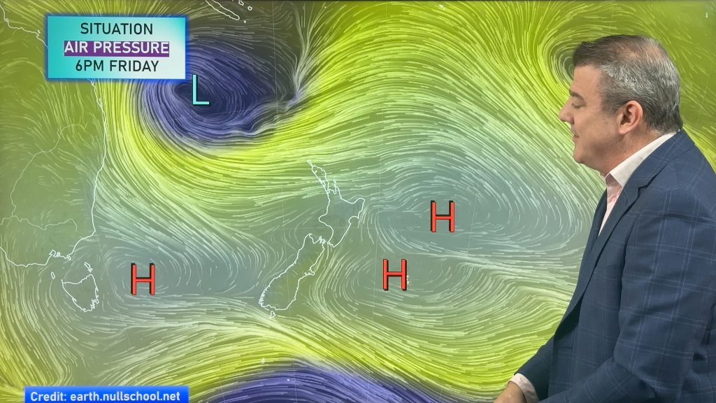
A few showers, but still a lot of high pressure
Showers continue in parts of NZ going into the weekend and through next week, we track them for you –…
Related Articles

ClimateWatch: May outlook & El Niño discussion
Everyone is talking about El Niño so in this month’s update we discuss when it may be forming and what…
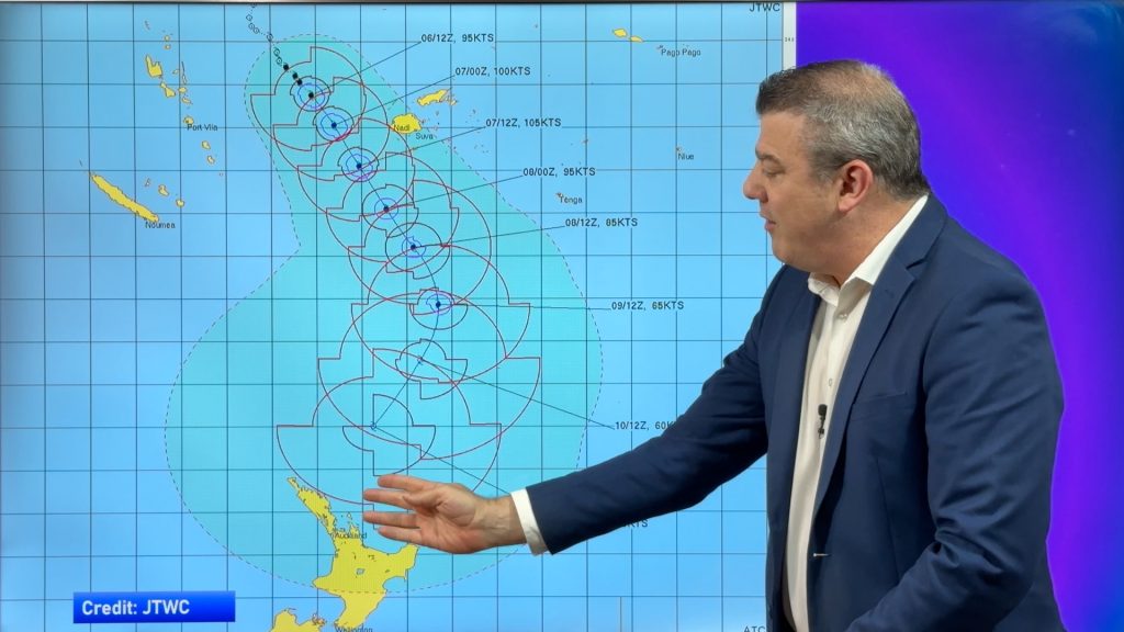
Tropical Cyclone VAIANU: Fiji then NZ
*Published Tuesday AM* Fiji is being affected today by offshore Severe Tropical Cyclone Vaianu and NZ has the chance of…

NZ Easter Weather Update + monitoring the tropics for storm potential
High pressure smothers New Zealand as we head into the long weekend bringing mostly dry weather and light winds, with…

